You are here: Home > Network List > AZ - ANZA Regional Network Stations List
> Station SMER AZ.SMER > Earthquake Result Viewer
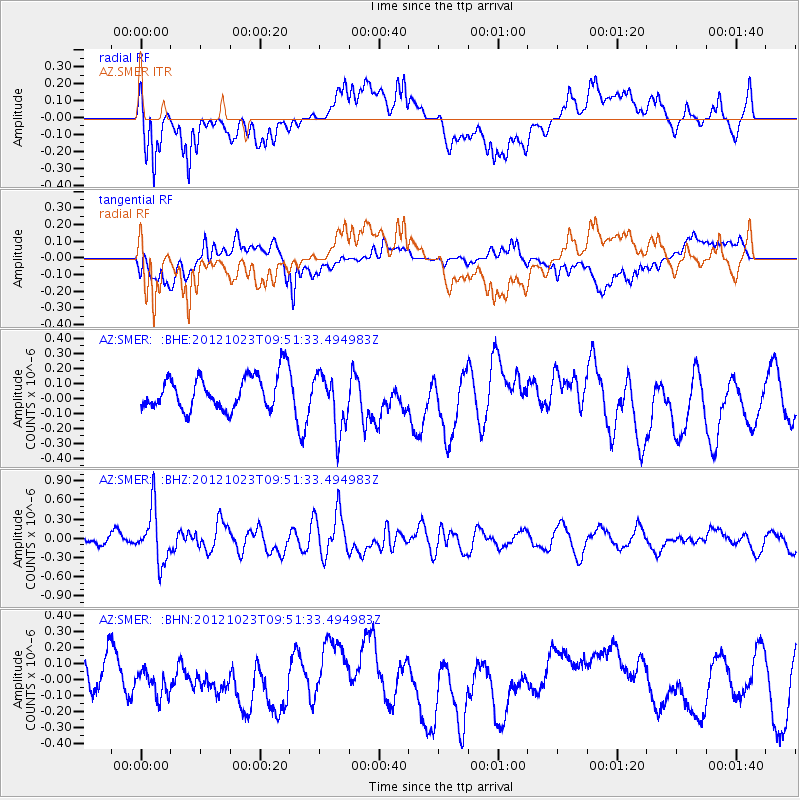
SMER AZ.SMER - Earthquake Result Viewer
*The percent match for this event was below the threshold and hence no stack was calculated.
| Earthquake location: |
Southeast Of Loyalty Islands |
| Earthquake latitude/longitude: |
-22.3/171.7 |
| Earthquake time(UTC): |
2012/10/23 (297) 09:39:30 GMT |
| Earthquake Depth: |
123 km |
| Earthquake Magnitude: |
5.9 MB, 5.8 MW, 5.9 MW |
| Earthquake Catalog/Contributor: |
WHDF/NEIC |
|
| Network: |
AZ ANZA Regional Network |
| Station: |
SMER AZ.SMER |
| Lat/Lon: |
33.46 N/117.17 W |
| Elevation: |
355 m |
|
| Distance: |
87.5 deg |
| Az: |
52.357 deg |
| Baz: |
241.296 deg |
| Ray Param: |
$rayparam |
*The percent match for this event was below the threshold and hence was not used in the summary stack. |
|
| Radial Match: |
71.70788 % |
| Radial Bump: |
400 |
| Transverse Match: |
41.686214 % |
| Transverse Bump: |
400 |
| SOD ConfigId: |
478790 |
| Insert Time: |
2013-02-25 14:42:17.928 +0000 |
| GWidth: |
2.5 |
| Max Bumps: |
400 |
| Tol: |
0.001 |
|
Signal To Noise
| Channel | StoN | STA | LTA |
| AZ:SMER: :BHZ:20121023T09:51:33.494983Z | 6.2182765 | 4.138416E-7 | 6.655246E-8 |
| AZ:SMER: :BHN:20121023T09:51:33.494983Z | 0.63976055 | 7.5171414E-8 | 1.174993E-7 |
| AZ:SMER: :BHE:20121023T09:51:33.494983Z | 1.7025173 | 1.9314938E-7 | 1.1344929E-7 |
| Arrivals |
| Ps | |
| PpPs | |
| PsPs/PpSs | |


