You are here: Home > Network List > CI - Caltech Regional Seismic Network Stations List
> Station RPV Rancho Palos Verdes, California, USA > Earthquake Result Viewer
RPV Rancho Palos Verdes, California, USA - Earthquake Result Viewer
*The percent match for this event was below the threshold and hence no stack was calculated.
| Earthquake location: |
Southeast Of Loyalty Islands |
| Earthquake latitude/longitude: |
-22.3/171.7 |
| Earthquake time(UTC): |
2012/10/23 (297) 09:39:30 GMT |
| Earthquake Depth: |
123 km |
| Earthquake Magnitude: |
5.9 MB, 5.8 MW, 5.9 MW |
| Earthquake Catalog/Contributor: |
WHDF/NEIC |
|
| Network: |
CI Caltech Regional Seismic Network |
| Station: |
RPV Rancho Palos Verdes, California, USA |
| Lat/Lon: |
33.74 N/118.40 W |
| Elevation: |
64 m |
|
| Distance: |
86.8 deg |
| Az: |
51.607 deg |
| Baz: |
240.579 deg |
| Ray Param: |
$rayparam |
*The percent match for this event was below the threshold and hence was not used in the summary stack. |
|
| Radial Match: |
63.119728 % |
| Radial Bump: |
400 |
| Transverse Match: |
44.429054 % |
| Transverse Bump: |
400 |
| SOD ConfigId: |
478790 |
| Insert Time: |
2013-02-25 14:45:45.346 +0000 |
| GWidth: |
2.5 |
| Max Bumps: |
400 |
| Tol: |
0.001 |
|
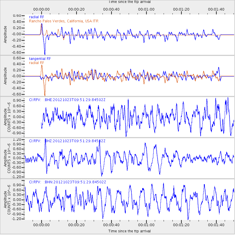
Signal To Noise
| Channel | StoN | STA | LTA |
| CI:RPV: :BHZ:20121023T09:51:29.84502Z | 1.9889674 | 5.0826634E-7 | 2.555428E-7 |
| CI:RPV: :BHN:20121023T09:51:29.84502Z | 1.5673944 | 4.4274043E-7 | 2.8246905E-7 |
| CI:RPV: :BHE:20121023T09:51:29.84502Z | 1.2625006 | 3.465901E-7 | 2.7452668E-7 |
| Arrivals |
| Ps | |
| PpPs | |
| PsPs/PpSs | |


