You are here: Home > Network List > G - GEOSCOPE Stations List
> Station WUS Wushi, Xinjiang Uygur, China > Earthquake Result Viewer
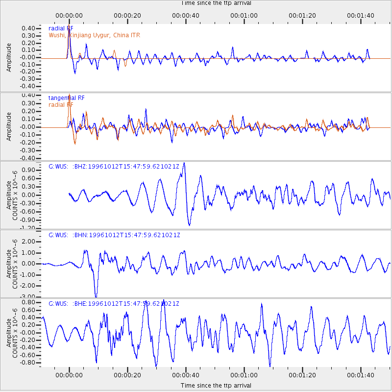
WUS Wushi, Xinjiang Uygur, China - Earthquake Result Viewer
*The percent match for this event was below the threshold and hence no stack was calculated.
| Earthquake location: |
Solomon Islands |
| Earthquake latitude/longitude: |
-7.2/155.5 |
| Earthquake time(UTC): |
1996/10/12 (286) 15:36:01 GMT |
| Earthquake Depth: |
33 km |
| Earthquake Magnitude: |
5.4 MB, 5.9 MS, 6.0 UNKNOWN, 6.0 MW |
| Earthquake Catalog/Contributor: |
WHDF/NEIC |
|
| Network: |
G GEOSCOPE |
| Station: |
WUS Wushi, Xinjiang Uygur, China |
| Lat/Lon: |
41.20 N/79.22 E |
| Elevation: |
1457 m |
|
| Distance: |
84.5 deg |
| Az: |
312.577 deg |
| Baz: |
104.504 deg |
| Ray Param: |
$rayparam |
*The percent match for this event was below the threshold and hence was not used in the summary stack. |
|
| Radial Match: |
78.43194 % |
| Radial Bump: |
342 |
| Transverse Match: |
70.94289 % |
| Transverse Bump: |
400 |
| SOD ConfigId: |
4480 |
| Insert Time: |
2010-02-27 01:06:28.256 +0000 |
| GWidth: |
2.5 |
| Max Bumps: |
400 |
| Tol: |
0.001 |
|
Signal To Noise
| Channel | StoN | STA | LTA |
| G:WUS: :BHN:19961012T15:47:59.621021Z | 1.2552749 | 2.0738322E-7 | 1.6520941E-7 |
| G:WUS: :BHE:19961012T15:47:59.621021Z | 0.58339566 | 1.299565E-7 | 2.2275877E-7 |
| G:WUS: :BHZ:19961012T15:47:59.621021Z | 2.5029967 | 3.8251525E-7 | 1.5282292E-7 |
| Arrivals |
| Ps | |
| PpPs | |
| PsPs/PpSs | |


