You are here: Home > Network List > G - GEOSCOPE Stations List
> Station WUS Wushi, Xinjiang Uygur, China > Earthquake Result Viewer
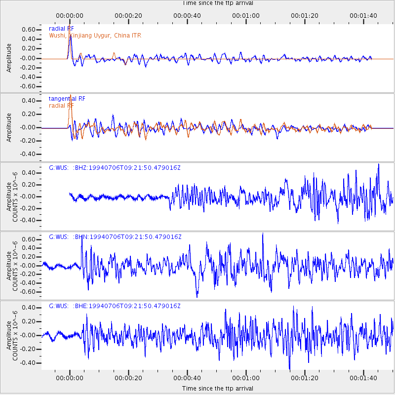
WUS Wushi, Xinjiang Uygur, China - Earthquake Result Viewer
*The percent match for this event was below the threshold and hence no stack was calculated.
| Earthquake location: |
Mindanao, Philippines |
| Earthquake latitude/longitude: |
6.0/125.9 |
| Earthquake time(UTC): |
1994/07/06 (187) 09:13:11 GMT |
| Earthquake Depth: |
164 km |
| Earthquake Magnitude: |
5.7 MB, 6.1 UNKNOWN |
| Earthquake Catalog/Contributor: |
WHDF/NEIC |
|
| Network: |
G GEOSCOPE |
| Station: |
WUS Wushi, Xinjiang Uygur, China |
| Lat/Lon: |
41.20 N/79.22 E |
| Elevation: |
1457 m |
|
| Distance: |
54.4 deg |
| Az: |
317.49 deg |
| Baz: |
117.043 deg |
| Ray Param: |
$rayparam |
*The percent match for this event was below the threshold and hence was not used in the summary stack. |
|
| Radial Match: |
78.97067 % |
| Radial Bump: |
400 |
| Transverse Match: |
66.39162 % |
| Transverse Bump: |
400 |
| SOD ConfigId: |
4480 |
| Insert Time: |
2010-02-27 01:06:29.123 +0000 |
| GWidth: |
2.5 |
| Max Bumps: |
400 |
| Tol: |
0.001 |
|
Signal To Noise
| Channel | StoN | STA | LTA |
| G:WUS: :BHN:19940706T09:21:50.479016Z | 3.6787925 | 1.6067614E-7 | 4.3676327E-8 |
| G:WUS: :BHE:19940706T09:21:50.479016Z | 1.2969818 | 4.4289735E-8 | 3.4148307E-8 |
| G:WUS: :BHZ:19940706T09:21:50.479016Z | 2.09137 | 5.8223176E-8 | 2.7839727E-8 |
| Arrivals |
| Ps | |
| PpPs | |
| PsPs/PpSs | |


