You are here: Home > Network List > TA - USArray Transportable Network (new EarthScope stations) Stations List
> Station 243A Waterproof, LA, USA > Earthquake Result Viewer
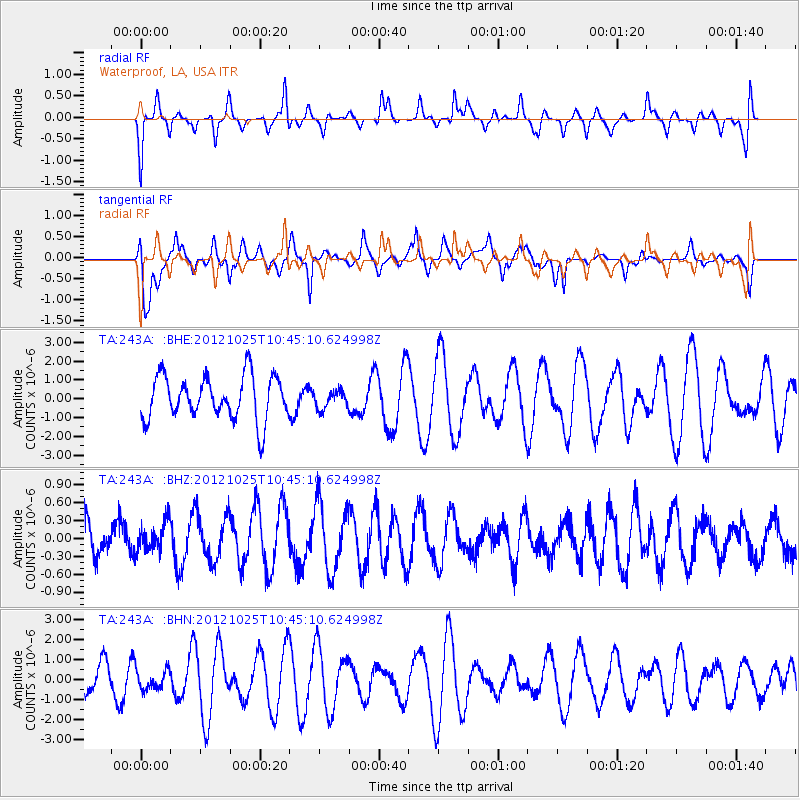
243A Waterproof, LA, USA - Earthquake Result Viewer
*The percent match for this event was below the threshold and hence no stack was calculated.
| Earthquake location: |
Near East Coast Of Honshu, Japan |
| Earthquake latitude/longitude: |
38.3/141.7 |
| Earthquake time(UTC): |
2012/10/25 (299) 10:32:28 GMT |
| Earthquake Depth: |
56 km |
| Earthquake Magnitude: |
5.5 MB, 5.6 MW, 5.7 MW |
| Earthquake Catalog/Contributor: |
WHDF/NEIC |
|
| Network: |
TA USArray Transportable Network (new EarthScope stations) |
| Station: |
243A Waterproof, LA, USA |
| Lat/Lon: |
31.88 N/91.48 W |
| Elevation: |
2.0 m |
|
| Distance: |
94.4 deg |
| Az: |
43.083 deg |
| Baz: |
320.827 deg |
| Ray Param: |
$rayparam |
*The percent match for this event was below the threshold and hence was not used in the summary stack. |
|
| Radial Match: |
59.259262 % |
| Radial Bump: |
339 |
| Transverse Match: |
44.21268 % |
| Transverse Bump: |
368 |
| SOD ConfigId: |
478790 |
| Insert Time: |
2013-02-25 16:00:58.310 +0000 |
| GWidth: |
2.5 |
| Max Bumps: |
400 |
| Tol: |
0.001 |
|
Signal To Noise
| Channel | StoN | STA | LTA |
| TA:243A: :BHZ:20121025T10:45:10.624998Z | 0.70255536 | 2.430357E-7 | 3.45931E-7 |
| TA:243A: :BHN:20121025T10:45:10.624998Z | 0.5504553 | 4.9822756E-7 | 9.051191E-7 |
| TA:243A: :BHE:20121025T10:45:10.624998Z | 0.41487765 | 4.793785E-7 | 1.1554696E-6 |
| Arrivals |
| Ps | |
| PpPs | |
| PsPs/PpSs | |


