You are here: Home > Network List > TA - USArray Transportable Network (new EarthScope stations) Stations List
> Station N42A Yates City, IL, USA > Earthquake Result Viewer
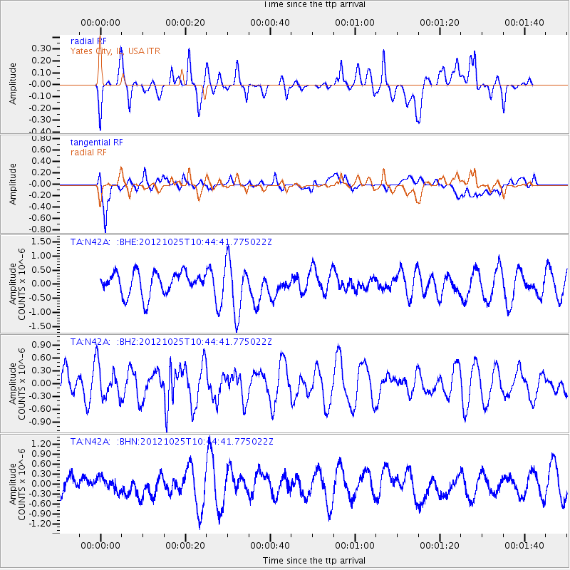
N42A Yates City, IL, USA - Earthquake Result Viewer
*The percent match for this event was below the threshold and hence no stack was calculated.
| Earthquake location: |
Near East Coast Of Honshu, Japan |
| Earthquake latitude/longitude: |
38.3/141.7 |
| Earthquake time(UTC): |
2012/10/25 (299) 10:32:28 GMT |
| Earthquake Depth: |
56 km |
| Earthquake Magnitude: |
5.5 MB, 5.6 MW, 5.7 MW |
| Earthquake Catalog/Contributor: |
WHDF/NEIC |
|
| Network: |
TA USArray Transportable Network (new EarthScope stations) |
| Station: |
N42A Yates City, IL, USA |
| Lat/Lon: |
40.83 N/90.03 W |
| Elevation: |
205 m |
|
| Distance: |
88.1 deg |
| Az: |
36.591 deg |
| Baz: |
321.829 deg |
| Ray Param: |
$rayparam |
*The percent match for this event was below the threshold and hence was not used in the summary stack. |
|
| Radial Match: |
42.76498 % |
| Radial Bump: |
400 |
| Transverse Match: |
75.149734 % |
| Transverse Bump: |
400 |
| SOD ConfigId: |
478790 |
| Insert Time: |
2013-02-25 16:02:04.160 +0000 |
| GWidth: |
2.5 |
| Max Bumps: |
400 |
| Tol: |
0.001 |
|
Signal To Noise
| Channel | StoN | STA | LTA |
| TA:N42A: :BHZ:20121025T10:44:41.775022Z | 0.8638358 | 3.7496062E-7 | 4.340647E-7 |
| TA:N42A: :BHN:20121025T10:44:41.775022Z | 0.7301903 | 1.9324939E-7 | 2.6465622E-7 |
| TA:N42A: :BHE:20121025T10:44:41.775022Z | 2.2970986 | 9.19381E-7 | 4.0023573E-7 |
| Arrivals |
| Ps | |
| PpPs | |
| PsPs/PpSs | |


