TAM Tamanrasset, Algeria - Earthquake Result Viewer
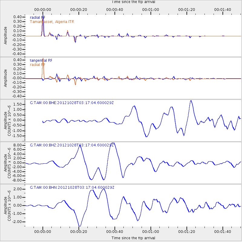
Earthquake location: Queen Charlotte Islands Region
Earthquake latitude/longitude: 52.8/-132.1
Earthquake time(UTC): 2012/10/28 (302) 03:04:08 GMT
Earthquake Depth: 14 km
Earthquake Magnitude: 6.5 MB, 7.5 MS, 7.8 MW, 7.8 MW
Earthquake Catalog/Contributor: WHDF/NEIC
Network: G GEOSCOPE
Station: TAM Tamanrasset, Algeria
Lat/Lon: 22.79 N/5.53 E
Elevation: 1377 m
Distance: 96.2 deg
Az: 38.727 deg
Baz: 335.687 deg
Ray Param: 0.0405763
Estimated Moho Depth: 33.5 km
Estimated Crust Vp/Vs: 1.83
Assumed Crust Vp: 6.61 km/s
Estimated Crust Vs: 3.622 km/s
Estimated Crust Poisson's Ratio: 0.29
Radial Match: 98.796974 %
Radial Bump: 200
Transverse Match: 91.566086 %
Transverse Bump: 400
SOD ConfigId: 478790
Insert Time: 2013-03-01 08:20:10.796 +0000
GWidth: 2.5
Max Bumps: 400
Tol: 0.001

Signal To Noise

ChannelStoNSTALTA
G:TAM:00:BHZ:20121028T03:17:04.600029Z3.70999384.976516E-71.3413812E-7
G:TAM:00:BHN:20121028T03:17:04.600029Z1.5618571.1623003E-77.441784E-8
G:TAM:00:BHE:20121028T03:17:04.600029Z1.28354321.1648918E-79.075595E-8
Arrivals
Ps4.3 SECOND
PpPs14 SECOND
PsPs/PpSs18 SECOND