You are here: Home > Network List > G - GEOSCOPE Stations List
> Station WUS Wushi, Xinjiang Uygur, China > Earthquake Result Viewer
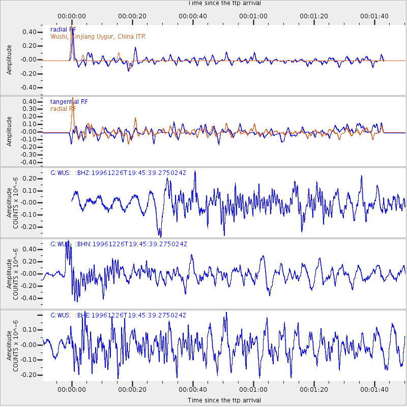
WUS Wushi, Xinjiang Uygur, China - Earthquake Result Viewer
*The percent match for this event was below the threshold and hence no stack was calculated.
| Earthquake location: |
New Britain Region, P.N.G. |
| Earthquake latitude/longitude: |
-5.4/151.4 |
| Earthquake time(UTC): |
1996/12/26 (361) 19:34:11 GMT |
| Earthquake Depth: |
107 km |
| Earthquake Magnitude: |
5.5 MS, 5.3 MB, 5.8 UNKNOWN, 5.8 MW |
| Earthquake Catalog/Contributor: |
WHDF/NEIC |
|
| Network: |
G GEOSCOPE |
| Station: |
WUS Wushi, Xinjiang Uygur, China |
| Lat/Lon: |
41.20 N/79.22 E |
| Elevation: |
1457 m |
|
| Distance: |
80.2 deg |
| Az: |
313.214 deg |
| Baz: |
105.925 deg |
| Ray Param: |
$rayparam |
*The percent match for this event was below the threshold and hence was not used in the summary stack. |
|
| Radial Match: |
67.80842 % |
| Radial Bump: |
400 |
| Transverse Match: |
55.96405 % |
| Transverse Bump: |
400 |
| SOD ConfigId: |
4480 |
| Insert Time: |
2010-02-27 01:06:58.218 +0000 |
| GWidth: |
2.5 |
| Max Bumps: |
400 |
| Tol: |
0.001 |
|
Signal To Noise
| Channel | StoN | STA | LTA |
| G:WUS: :BHN:19961226T19:45:39.275024Z | 5.6693316 | 2.5395525E-7 | 4.4794565E-8 |
| G:WUS: :BHE:19961226T19:45:39.275024Z | 1.5019951 | 1.0213957E-7 | 6.80026E-8 |
| G:WUS: :BHZ:19961226T19:45:39.275024Z | 3.019231 | 1.3857198E-7 | 4.5896446E-8 |
| Arrivals |
| Ps | |
| PpPs | |
| PsPs/PpSs | |


