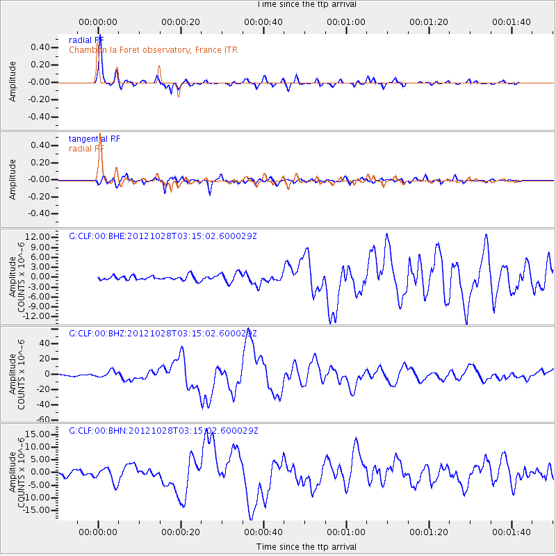
CLF Chambon la Foret observatory, France - Earthquake Result Viewer
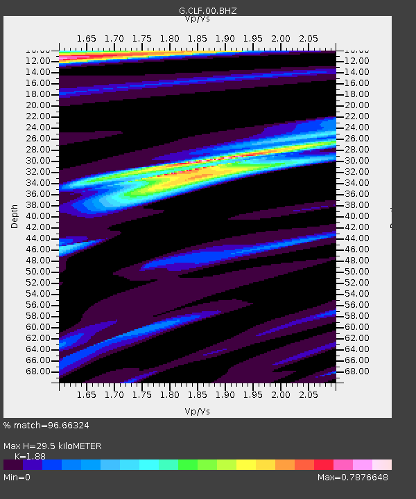
Earthquake location: Queen Charlotte Islands Region
Earthquake latitude/longitude: 52.8/-132.1
Earthquake time(UTC): 2012/10/28 (302) 03:04:08 GMT
Earthquake Depth: 14 km
Earthquake Magnitude: 6.5 MB, 7.5 MS, 7.8 MW, 7.8 MW
Earthquake Catalog/Contributor: WHDF/NEIC
Network: G GEOSCOPE
Station: CLF Chambon la Foret observatory, France
Lat/Lon: 48.03 N/2.26 E
Elevation: 145 m
Distance: 72.3 deg
Az: 30.247 deg
Baz: 332.886 deg
Ray Param: 0.053734634
Estimated Moho Depth: 29.5 km
Estimated Crust Vp/Vs: 1.88
Assumed Crust Vp: 6.12 km/s
Estimated Crust Vs: 3.255 km/s
Estimated Crust Poisson's Ratio: 0.30
Radial Match: 96.66324 %
Radial Bump: 400
Transverse Match: 91.39001 %
Transverse Bump: 400
SOD ConfigId: 478790
Insert Time: 2013-03-01 08:20:28.407 +0000
GWidth: 2.5
Max Bumps: 400
Tol: 0.001

Signal To Noise

ChannelStoNSTALTA
G:CLF:00:BHZ:20121028T03:15:02.600029Z4.1149434.4605954E-61.0839993E-6
G:CLF:00:BHN:20121028T03:15:02.600029Z3.70881443.0381323E-68.1916534E-7
G:CLF:00:BHE:20121028T03:15:02.600029Z2.3821411.5306657E-66.425588E-7
Arrivals
Ps4.4 SECOND
PpPs13 SECOND
PsPs/PpSs18 SECOND