You are here: Home > Network List > G - GEOSCOPE Stations List
> Station WUS Wushi, Xinjiang Uygur, China > Earthquake Result Viewer
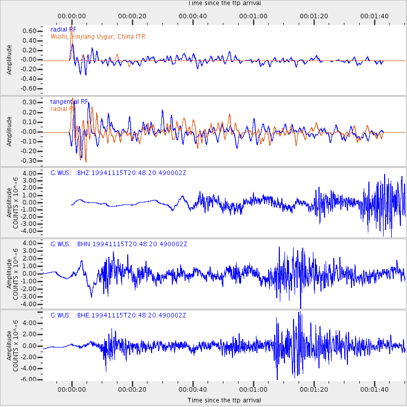
WUS Wushi, Xinjiang Uygur, China - Earthquake Result Viewer
*The percent match for this event was below the threshold and hence no stack was calculated.
| Earthquake location: |
East Of Kuril Islands |
| Earthquake latitude/longitude: |
47.5/155.1 |
| Earthquake time(UTC): |
1994/11/15 (319) 20:39:40 GMT |
| Earthquake Depth: |
33 km |
| Earthquake Magnitude: |
5.7 MB, 6.0 MS, 5.6 UNKNOWN, 6.0 MW |
| Earthquake Catalog/Contributor: |
WHDF/NEIC |
|
| Network: |
G GEOSCOPE |
| Station: |
WUS Wushi, Xinjiang Uygur, China |
| Lat/Lon: |
41.20 N/79.22 E |
| Elevation: |
1457 m |
|
| Distance: |
52.6 deg |
| Az: |
292.961 deg |
| Baz: |
55.895 deg |
| Ray Param: |
$rayparam |
*The percent match for this event was below the threshold and hence was not used in the summary stack. |
|
| Radial Match: |
63.638367 % |
| Radial Bump: |
400 |
| Transverse Match: |
60.96576 % |
| Transverse Bump: |
400 |
| SOD ConfigId: |
4480 |
| Insert Time: |
2010-02-27 01:06:59.906 +0000 |
| GWidth: |
2.5 |
| Max Bumps: |
400 |
| Tol: |
0.001 |
|
Signal To Noise
| Channel | StoN | STA | LTA |
| G:WUS: :BHN:19941115T20:48:20.490002Z | 2.0039082 | 6.8635836E-7 | 3.4250988E-7 |
| G:WUS: :BHE:19941115T20:48:20.490002Z | 0.6331158 | 1.9836848E-7 | 3.13321E-7 |
| G:WUS: :BHZ:19941115T20:48:20.490002Z | 1.7124859 | 4.1572963E-7 | 2.4276383E-7 |
| Arrivals |
| Ps | |
| PpPs | |
| PsPs/PpSs | |


