BRNJ Basking Ridge, New Jersey - Earthquake Result Viewer
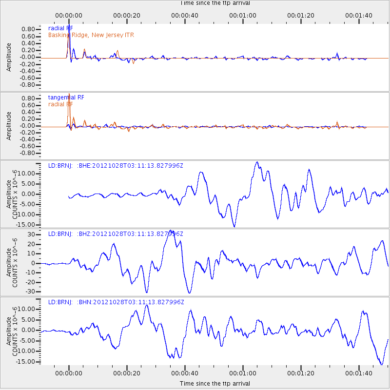
Earthquake location: Queen Charlotte Islands Region
Earthquake latitude/longitude: 52.8/-132.1
Earthquake time(UTC): 2012/10/28 (302) 03:04:08 GMT
Earthquake Depth: 14 km
Earthquake Magnitude: 6.5 MB, 7.5 MS, 7.8 MW, 7.8 MW
Earthquake Catalog/Contributor: WHDF/NEIC
Network: LD Lamont-Doherty Cooperative Seismographic Network
Station: BRNJ Basking Ridge, New Jersey
Lat/Lon: 40.68 N/74.57 W
Elevation: 50 m
Distance: 40.2 deg
Az: 83.768 deg
Baz: 307.449 deg
Ray Param: 0.07452099
Estimated Moho Depth: 35.0 km
Estimated Crust Vp/Vs: 1.93
Assumed Crust Vp: 6.283 km/s
Estimated Crust Vs: 3.26 km/s
Estimated Crust Poisson's Ratio: 0.32
Radial Match: 95.027374 %
Radial Bump: 353
Transverse Match: 67.28815 %
Transverse Bump: 400
SOD ConfigId: 478790
Insert Time: 2013-03-01 08:24:32.006 +0000
GWidth: 2.5
Max Bumps: 400
Tol: 0.001

Signal To Noise

ChannelStoNSTALTA
LD:BRNJ: :BHZ:20121028T03:11:13.827996Z3.70207293.1215375E-68.431864E-7
LD:BRNJ: :BHN:20121028T03:11:13.827996Z1.67631851.2322788E-67.351102E-7
LD:BRNJ: :BHE:20121028T03:11:13.827996Z2.34124421.5313349E-66.5406886E-7
Arrivals
Ps5.5 SECOND
PpPs15 SECOND
PsPs/PpSs21 SECOND