You are here: Home > Network List > CN - Canadian National Seismograph Network Stations List
> Station INK INUVIK, NT > Earthquake Result Viewer
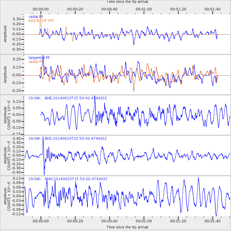
INK INUVIK, NT - Earthquake Result Viewer
*The percent match for this event was below the threshold and hence no stack was calculated.
| Earthquake location: |
New Britain Region, P.N.G. |
| Earthquake latitude/longitude: |
-4.8/152.7 |
| Earthquake time(UTC): |
2014/06/20 (171) 15:46:45 GMT |
| Earthquake Depth: |
60 km |
| Earthquake Magnitude: |
5.2 MW |
| Earthquake Catalog/Contributor: |
ISC/ISC |
|
| Network: |
CN Canadian National Seismograph Network |
| Station: |
INK INUVIK, NT |
| Lat/Lon: |
68.31 N/133.53 W |
| Elevation: |
44 m |
|
| Distance: |
88.5 deg |
| Az: |
20.921 deg |
| Baz: |
253.17 deg |
| Ray Param: |
$rayparam |
*The percent match for this event was below the threshold and hence was not used in the summary stack. |
|
| Radial Match: |
54.521324 % |
| Radial Bump: |
400 |
| Transverse Match: |
53.901142 % |
| Transverse Bump: |
400 |
| SOD ConfigId: |
3390531 |
| Insert Time: |
2019-04-12 08:59:15.859 +0000 |
| GWidth: |
2.5 |
| Max Bumps: |
400 |
| Tol: |
0.001 |
|
Signal To Noise
| Channel | StoN | STA | LTA |
| CN:INK: :BHZ:20140620T15:59:00.474993Z | 2.3620043 | 1.655728E-7 | 7.009843E-8 |
| CN:INK: :BHN:20140620T15:59:00.474993Z | 0.82381874 | 4.724959E-8 | 5.735435E-8 |
| CN:INK: :BHE:20140620T15:59:00.474993Z | 1.1836028 | 5.5016937E-8 | 4.64826E-8 |
| Arrivals |
| Ps | |
| PpPs | |
| PsPs/PpSs | |


