You are here: Home > Network List > G - GEOSCOPE Stations List
> Station WUS Wushi, Xinjiang Uygur, China > Earthquake Result Viewer
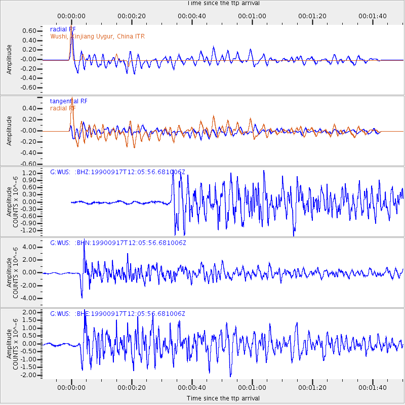
WUS Wushi, Xinjiang Uygur, China - Earthquake Result Viewer
*The percent match for this event was below the threshold and hence no stack was calculated.
| Earthquake location: |
Southern Sumatra, Indonesia |
| Earthquake latitude/longitude: |
-5.9/103.8 |
| Earthquake time(UTC): |
1990/09/17 (260) 11:57:20 GMT |
| Earthquake Depth: |
33 km |
| Earthquake Magnitude: |
5.7 MB, 5.5 MS |
| Earthquake Catalog/Contributor: |
WHDF/NEIC |
|
| Network: |
G GEOSCOPE |
| Station: |
WUS Wushi, Xinjiang Uygur, China |
| Lat/Lon: |
41.20 N/79.22 E |
| Elevation: |
1457 m |
|
| Distance: |
52.0 deg |
| Az: |
336.547 deg |
| Baz: |
148.357 deg |
| Ray Param: |
$rayparam |
*The percent match for this event was below the threshold and hence was not used in the summary stack. |
|
| Radial Match: |
79.38685 % |
| Radial Bump: |
400 |
| Transverse Match: |
78.35009 % |
| Transverse Bump: |
400 |
| SOD ConfigId: |
4480 |
| Insert Time: |
2010-02-27 01:08:15.739 +0000 |
| GWidth: |
2.5 |
| Max Bumps: |
400 |
| Tol: |
0.001 |
|
Signal To Noise
| Channel | StoN | STA | LTA |
| G:WUS: :BHN:19900917T12:05:56.681006Z | 21.855656 | 1.5184025E-6 | 6.947412E-8 |
| G:WUS: :BHE:19900917T12:05:56.681006Z | 19.35477 | 7.297903E-7 | 3.7705966E-8 |
| G:WUS: :BHZ:19900917T12:05:56.681006Z | 14.317899 | 5.047126E-7 | 3.5250466E-8 |
| Arrivals |
| Ps | |
| PpPs | |
| PsPs/PpSs | |


