You are here: Home > Network List > TA - USArray Transportable Network (new EarthScope stations) Stations List
> Station T42A Van Buren, MO, USA > Earthquake Result Viewer
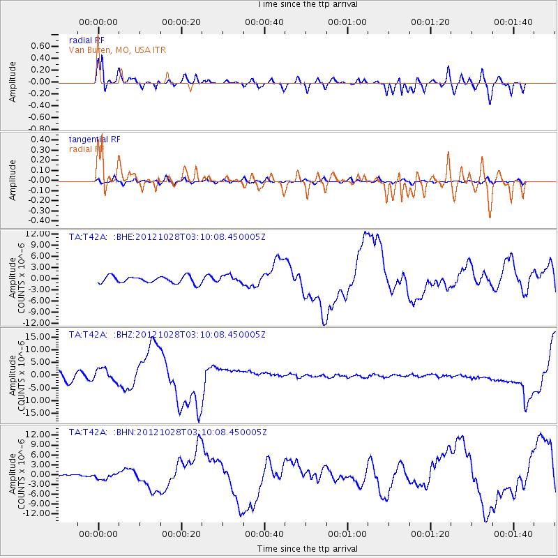
T42A Van Buren, MO, USA - Earthquake Result Viewer
*The percent match for this event was below the threshold and hence no stack was calculated.
| Earthquake location: |
Queen Charlotte Islands Region |
| Earthquake latitude/longitude: |
52.8/-132.1 |
| Earthquake time(UTC): |
2012/10/28 (302) 03:04:08 GMT |
| Earthquake Depth: |
14 km |
| Earthquake Magnitude: |
6.5 MB, 7.5 MS, 7.8 MW, 7.8 MW |
| Earthquake Catalog/Contributor: |
WHDF/NEIC |
|
| Network: |
TA USArray Transportable Network (new EarthScope stations) |
| Station: |
T42A Van Buren, MO, USA |
| Lat/Lon: |
37.03 N/91.09 W |
| Elevation: |
162 m |
|
| Distance: |
32.5 deg |
| Az: |
102.411 deg |
| Baz: |
312.167 deg |
| Ray Param: |
$rayparam |
*The percent match for this event was below the threshold and hence was not used in the summary stack. |
|
| Radial Match: |
46.243923 % |
| Radial Bump: |
364 |
| Transverse Match: |
32.792564 % |
| Transverse Bump: |
400 |
| SOD ConfigId: |
478790 |
| Insert Time: |
2013-03-01 08:41:53.733 +0000 |
| GWidth: |
2.5 |
| Max Bumps: |
400 |
| Tol: |
0.001 |
|
Signal To Noise
| Channel | StoN | STA | LTA |
| TA:T42A: :BHZ:20121028T03:10:08.450005Z | 1.6986353 | 2.4755507E-6 | 1.4573761E-6 |
| TA:T42A: :BHN:20121028T03:10:08.450005Z | 2.3175483 | 8.8933047E-7 | 3.837376E-7 |
| TA:T42A: :BHE:20121028T03:10:08.450005Z | 1.0982927 | 1.015718E-6 | 9.2481537E-7 |
| Arrivals |
| Ps | |
| PpPs | |
| PsPs/PpSs | |


