You are here: Home > Network List > G - GEOSCOPE Stations List
> Station WUS Wushi, Xinjiang Uygur, China > Earthquake Result Viewer
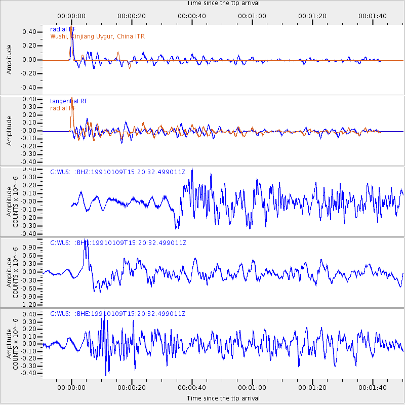
WUS Wushi, Xinjiang Uygur, China - Earthquake Result Viewer
*The percent match for this event was below the threshold and hence no stack was calculated.
| Earthquake location: |
New Britain Region, P.N.G. |
| Earthquake latitude/longitude: |
-5.4/151.8 |
| Earthquake time(UTC): |
1991/01/09 (009) 15:08:54 GMT |
| Earthquake Depth: |
38 km |
| Earthquake Magnitude: |
5.8 MB, 6.0 MS, 6.2 UNKNOWN |
| Earthquake Catalog/Contributor: |
WHDF/NEIC |
|
| Network: |
G GEOSCOPE |
| Station: |
WUS Wushi, Xinjiang Uygur, China |
| Lat/Lon: |
41.20 N/79.22 E |
| Elevation: |
1457 m |
|
| Distance: |
80.6 deg |
| Az: |
313.12 deg |
| Baz: |
105.637 deg |
| Ray Param: |
$rayparam |
*The percent match for this event was below the threshold and hence was not used in the summary stack. |
|
| Radial Match: |
79.909515 % |
| Radial Bump: |
400 |
| Transverse Match: |
56.42241 % |
| Transverse Bump: |
400 |
| SOD ConfigId: |
4480 |
| Insert Time: |
2010-02-27 01:08:39.754 +0000 |
| GWidth: |
2.5 |
| Max Bumps: |
400 |
| Tol: |
0.001 |
|
Signal To Noise
| Channel | StoN | STA | LTA |
| G:WUS: :BHN:19910109T15:20:32.499011Z | 6.0169873 | 3.8871747E-7 | 6.4603334E-8 |
| G:WUS: :BHE:19910109T15:20:32.499011Z | 1.3167933 | 7.5477914E-8 | 5.7319482E-8 |
| G:WUS: :BHZ:19910109T15:20:32.499011Z | 2.3755186 | 1.1285903E-7 | 4.7509218E-8 |
| Arrivals |
| Ps | |
| PpPs | |
| PsPs/PpSs | |


