You are here: Home > Network List > G - GEOSCOPE Stations List
> Station WUS Wushi, Xinjiang Uygur, China > Earthquake Result Viewer
WUS Wushi, Xinjiang Uygur, China - Earthquake Result Viewer
*The percent match for this event was below the threshold and hence no stack was calculated.
| Earthquake location: |
Kuril Islands |
| Earthquake latitude/longitude: |
48.2/154.4 |
| Earthquake time(UTC): |
1991/02/16 (047) 01:23:40 GMT |
| Earthquake Depth: |
44 km |
| Earthquake Magnitude: |
6.3 MB, 5.7 MS, 5.4 UNKNOWN |
| Earthquake Catalog/Contributor: |
WHDF/NEIC |
|
| Network: |
G GEOSCOPE |
| Station: |
WUS Wushi, Xinjiang Uygur, China |
| Lat/Lon: |
41.20 N/79.22 E |
| Elevation: |
1457 m |
|
| Distance: |
51.9 deg |
| Az: |
292.021 deg |
| Baz: |
55.243 deg |
| Ray Param: |
$rayparam |
*The percent match for this event was below the threshold and hence was not used in the summary stack. |
|
| Radial Match: |
74.1336 % |
| Radial Bump: |
400 |
| Transverse Match: |
71.83066 % |
| Transverse Bump: |
400 |
| SOD ConfigId: |
4480 |
| Insert Time: |
2010-02-27 01:08:47.664 +0000 |
| GWidth: |
2.5 |
| Max Bumps: |
400 |
| Tol: |
0.001 |
|
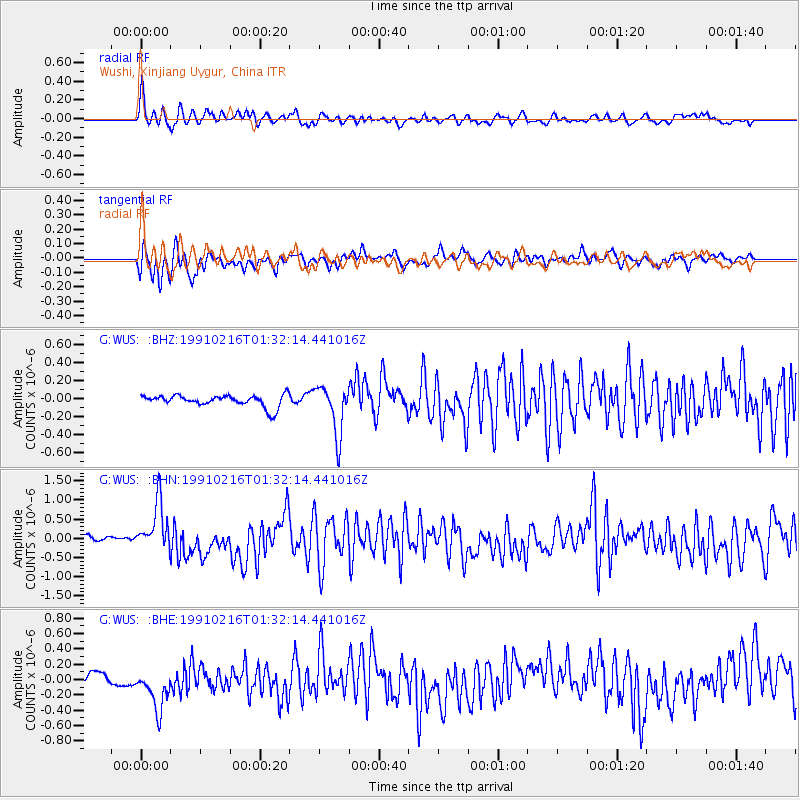
Signal To Noise
| Channel | StoN | STA | LTA |
| G:WUS: :BHN:19910216T01:32:14.441016Z | 9.350431 | 6.413254E-7 | 6.8587795E-8 |
| G:WUS: :BHE:19910216T01:32:14.441016Z | 4.2791724 | 2.857688E-7 | 6.678132E-8 |
| G:WUS: :BHZ:19910216T01:32:14.441016Z | 4.2189126 | 2.744551E-7 | 6.505351E-8 |
| Arrivals |
| Ps | |
| PpPs | |
| PsPs/PpSs | |


