You are here: Home > Network List > TA - USArray Transportable Network (new EarthScope stations) Stations List
> Station Y42A Garnett, Star City, AR, USA > Earthquake Result Viewer
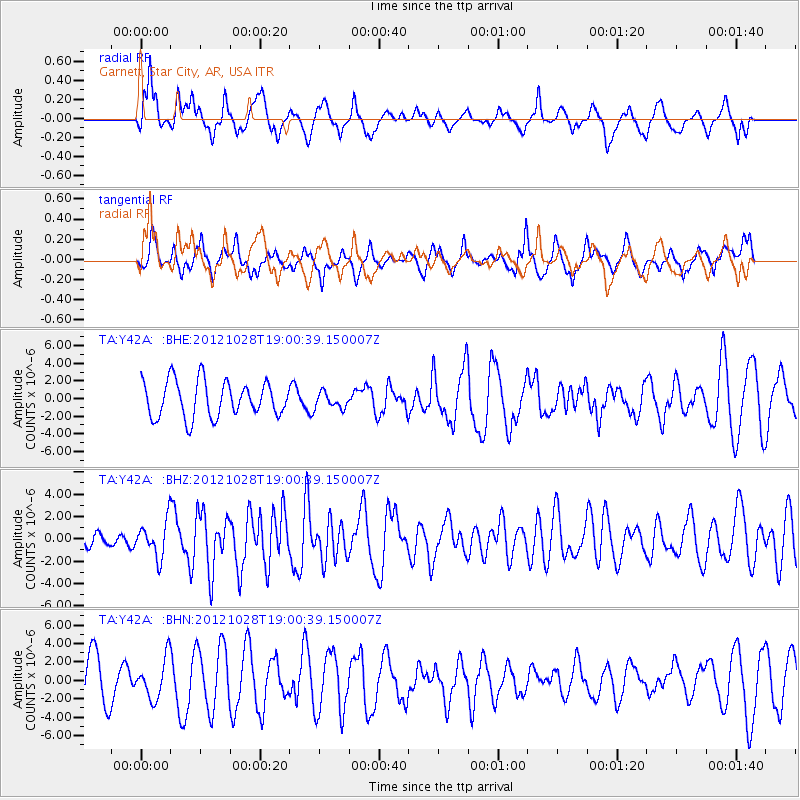
Y42A Garnett, Star City, AR, USA - Earthquake Result Viewer
*The percent match for this event was below the threshold and hence no stack was calculated.
| Earthquake location: |
Queen Charlotte Islands Region |
| Earthquake latitude/longitude: |
52.7/-132.6 |
| Earthquake time(UTC): |
2012/10/28 (302) 18:54:20 GMT |
| Earthquake Depth: |
9.0 km |
| Earthquake Magnitude: |
5.9 MB, 6.2 MS, 6.3 MW, 6.3 MW |
| Earthquake Catalog/Contributor: |
WHDF/NEIC |
|
| Network: |
TA USArray Transportable Network (new EarthScope stations) |
| Station: |
Y42A Garnett, Star City, AR, USA |
| Lat/Lon: |
33.84 N/91.79 W |
| Elevation: |
77 m |
|
| Distance: |
34.6 deg |
| Az: |
106.601 deg |
| Baz: |
315.487 deg |
| Ray Param: |
$rayparam |
*The percent match for this event was below the threshold and hence was not used in the summary stack. |
|
| Radial Match: |
57.73341 % |
| Radial Bump: |
389 |
| Transverse Match: |
72.05007 % |
| Transverse Bump: |
400 |
| SOD ConfigId: |
478790 |
| Insert Time: |
2013-03-01 09:12:59.882 +0000 |
| GWidth: |
2.5 |
| Max Bumps: |
400 |
| Tol: |
0.001 |
|
Signal To Noise
| Channel | StoN | STA | LTA |
| TA:Y42A: :BHZ:20121028T19:00:39.150007Z | 3.3376849 | 1.6125002E-6 | 4.831194E-7 |
| TA:Y42A: :BHN:20121028T19:00:39.150007Z | 1.1026955 | 2.1651742E-6 | 1.9635286E-6 |
| TA:Y42A: :BHE:20121028T19:00:39.150007Z | 0.43067557 | 8.795529E-7 | 2.0422633E-6 |
| Arrivals |
| Ps | |
| PpPs | |
| PsPs/PpSs | |


