You are here: Home > Network List > TA - USArray Transportable Network (new EarthScope stations) Stations List
> Station T44A Benton, MO, USA > Earthquake Result Viewer
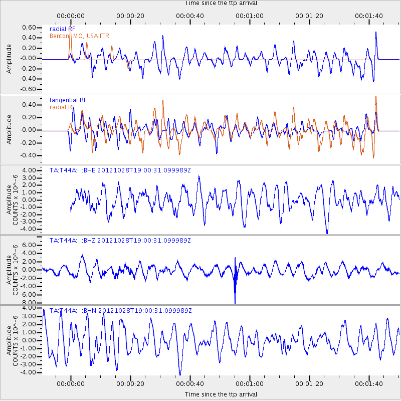
T44A Benton, MO, USA - Earthquake Result Viewer
*The percent match for this event was below the threshold and hence no stack was calculated.
| Earthquake location: |
Queen Charlotte Islands Region |
| Earthquake latitude/longitude: |
52.7/-132.6 |
| Earthquake time(UTC): |
2012/10/28 (302) 18:54:20 GMT |
| Earthquake Depth: |
9.0 km |
| Earthquake Magnitude: |
5.9 MB, 6.2 MS, 6.3 MW, 6.3 MW |
| Earthquake Catalog/Contributor: |
WHDF/NEIC |
|
| Network: |
TA USArray Transportable Network (new EarthScope stations) |
| Station: |
T44A Benton, MO, USA |
| Lat/Lon: |
37.09 N/89.59 W |
| Elevation: |
133 m |
|
| Distance: |
33.7 deg |
| Az: |
100.205 deg |
| Baz: |
311.46 deg |
| Ray Param: |
$rayparam |
*The percent match for this event was below the threshold and hence was not used in the summary stack. |
|
| Radial Match: |
49.416836 % |
| Radial Bump: |
400 |
| Transverse Match: |
41.31936 % |
| Transverse Bump: |
400 |
| SOD ConfigId: |
478790 |
| Insert Time: |
2013-03-01 09:14:46.443 +0000 |
| GWidth: |
2.5 |
| Max Bumps: |
400 |
| Tol: |
0.001 |
|
Signal To Noise
| Channel | StoN | STA | LTA |
| TA:T44A: :BHZ:20121028T19:00:31.099989Z | 3.001649 | 1.79103E-6 | 5.96682E-7 |
| TA:T44A: :BHN:20121028T19:00:31.099989Z | 0.71252424 | 1.2897464E-6 | 1.8101088E-6 |
| TA:T44A: :BHE:20121028T19:00:31.099989Z | 0.8083374 | 9.810699E-7 | 1.2136886E-6 |
| Arrivals |
| Ps | |
| PpPs | |
| PsPs/PpSs | |


