You are here: Home > Network List > TA - USArray Transportable Network (new EarthScope stations) Stations List
> Station H43A Windswept, Luxemburg, WI, USA > Earthquake Result Viewer
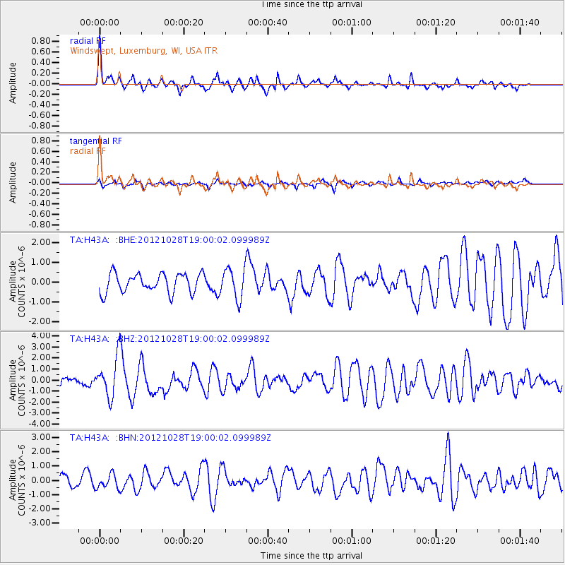
H43A Windswept, Luxemburg, WI, USA - Earthquake Result Viewer
*The percent match for this event was below the threshold and hence no stack was calculated.
| Earthquake location: |
Queen Charlotte Islands Region |
| Earthquake latitude/longitude: |
52.7/-132.6 |
| Earthquake time(UTC): |
2012/10/28 (302) 18:54:20 GMT |
| Earthquake Depth: |
9.0 km |
| Earthquake Magnitude: |
5.9 MB, 6.2 MS, 6.3 MW, 6.3 MW |
| Earthquake Catalog/Contributor: |
WHDF/NEIC |
|
| Network: |
TA USArray Transportable Network (new EarthScope stations) |
| Station: |
H43A Windswept, Luxemburg, WI, USA |
| Lat/Lon: |
44.47 N/87.77 W |
| Elevation: |
274 m |
|
| Distance: |
30.3 deg |
| Az: |
87.465 deg |
| Baz: |
301.826 deg |
| Ray Param: |
$rayparam |
*The percent match for this event was below the threshold and hence was not used in the summary stack. |
|
| Radial Match: |
79.81632 % |
| Radial Bump: |
374 |
| Transverse Match: |
58.450195 % |
| Transverse Bump: |
400 |
| SOD ConfigId: |
478790 |
| Insert Time: |
2013-03-01 09:15:51.162 +0000 |
| GWidth: |
2.5 |
| Max Bumps: |
400 |
| Tol: |
0.001 |
|
Signal To Noise
| Channel | StoN | STA | LTA |
| TA:H43A: :BHZ:20121028T19:00:02.099989Z | 3.5097277 | 1.8330687E-6 | 5.2228233E-7 |
| TA:H43A: :BHN:20121028T19:00:02.099989Z | 1.3389941 | 4.9376723E-7 | 3.687598E-7 |
| TA:H43A: :BHE:20121028T19:00:02.099989Z | 1.6446031 | 7.92227E-7 | 4.817132E-7 |
| Arrivals |
| Ps | |
| PpPs | |
| PsPs/PpSs | |


