You are here: Home > Network List > TA - USArray Transportable Network (new EarthScope stations) Stations List
> Station V48A Smith Brothers Farm, Spring Hill, TN, USA > Earthquake Result Viewer
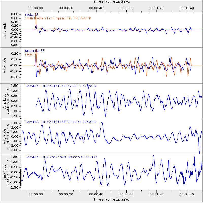
V48A Smith Brothers Farm, Spring Hill, TN, USA - Earthquake Result Viewer
*The percent match for this event was below the threshold and hence no stack was calculated.
| Earthquake location: |
Queen Charlotte Islands Region |
| Earthquake latitude/longitude: |
52.7/-132.6 |
| Earthquake time(UTC): |
2012/10/28 (302) 18:54:20 GMT |
| Earthquake Depth: |
9.0 km |
| Earthquake Magnitude: |
5.9 MB, 6.2 MS, 6.3 MW, 6.3 MW |
| Earthquake Catalog/Contributor: |
WHDF/NEIC |
|
| Network: |
TA USArray Transportable Network (new EarthScope stations) |
| Station: |
V48A Smith Brothers Farm, Spring Hill, TN, USA |
| Lat/Lon: |
35.74 N/86.82 W |
| Elevation: |
278 m |
|
| Distance: |
36.2 deg |
| Az: |
99.345 deg |
| Baz: |
312.391 deg |
| Ray Param: |
$rayparam |
*The percent match for this event was below the threshold and hence was not used in the summary stack. |
|
| Radial Match: |
69.776505 % |
| Radial Bump: |
368 |
| Transverse Match: |
51.03971 % |
| Transverse Bump: |
400 |
| SOD ConfigId: |
478790 |
| Insert Time: |
2013-03-01 09:17:19.416 +0000 |
| GWidth: |
2.5 |
| Max Bumps: |
400 |
| Tol: |
0.001 |
|
Signal To Noise
| Channel | StoN | STA | LTA |
| TA:V48A: :BHZ:20121028T19:00:53.125013Z | 2.1252217 | 1.5681627E-6 | 7.378819E-7 |
| TA:V48A: :BHN:20121028T19:00:53.125013Z | 0.63269407 | 3.3290007E-7 | 5.261628E-7 |
| TA:V48A: :BHE:20121028T19:00:53.125013Z | 1.8488963 | 1.0375305E-6 | 5.6116215E-7 |
| Arrivals |
| Ps | |
| PpPs | |
| PsPs/PpSs | |


