You are here: Home > Network List > TA - USArray Transportable Network (new EarthScope stations) Stations List
> Station 249A Camden, AL, USA > Earthquake Result Viewer
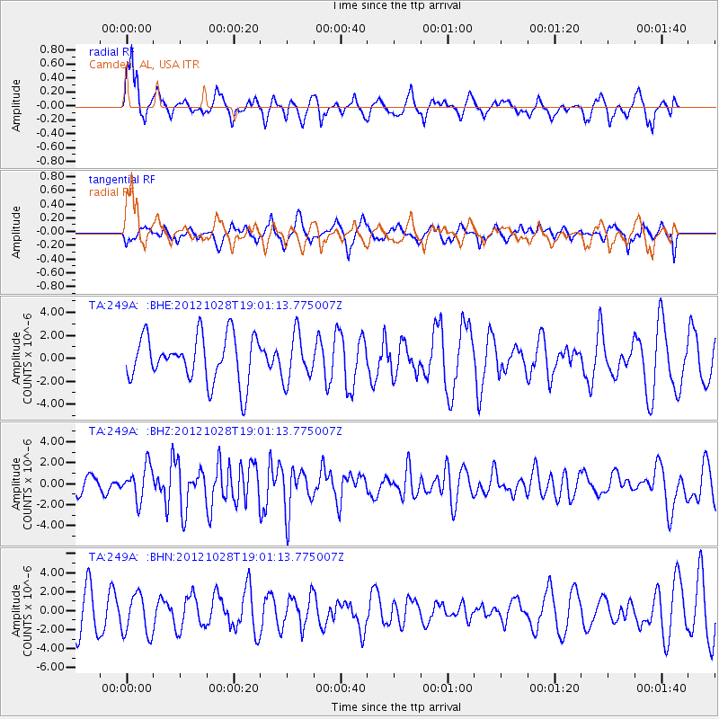
249A Camden, AL, USA - Earthquake Result Viewer
*The percent match for this event was below the threshold and hence no stack was calculated.
| Earthquake location: |
Queen Charlotte Islands Region |
| Earthquake latitude/longitude: |
52.7/-132.6 |
| Earthquake time(UTC): |
2012/10/28 (302) 18:54:20 GMT |
| Earthquake Depth: |
9.0 km |
| Earthquake Magnitude: |
5.9 MB, 6.2 MS, 6.3 MW, 6.3 MW |
| Earthquake Catalog/Contributor: |
WHDF/NEIC |
|
| Network: |
TA USArray Transportable Network (new EarthScope stations) |
| Station: |
249A Camden, AL, USA |
| Lat/Lon: |
31.98 N/87.12 W |
| Elevation: |
66 m |
|
| Distance: |
38.7 deg |
| Az: |
104.062 deg |
| Baz: |
315.971 deg |
| Ray Param: |
$rayparam |
*The percent match for this event was below the threshold and hence was not used in the summary stack. |
|
| Radial Match: |
70.41187 % |
| Radial Bump: |
400 |
| Transverse Match: |
48.75263 % |
| Transverse Bump: |
400 |
| SOD ConfigId: |
478790 |
| Insert Time: |
2013-03-01 09:17:46.051 +0000 |
| GWidth: |
2.5 |
| Max Bumps: |
400 |
| Tol: |
0.001 |
|
Signal To Noise
| Channel | StoN | STA | LTA |
| TA:249A: :BHZ:20121028T19:01:13.775007Z | 2.2629974 | 1.6043743E-6 | 7.089599E-7 |
| TA:249A: :BHN:20121028T19:01:13.775007Z | 1.2924447 | 2.1667565E-6 | 1.6764791E-6 |
| TA:249A: :BHE:20121028T19:01:13.775007Z | 1.0333369 | 2.060033E-6 | 1.9935737E-6 |
| Arrivals |
| Ps | |
| PpPs | |
| PsPs/PpSs | |


