You are here: Home > Network List > TA - USArray Transportable Network (new EarthScope stations) Stations List
> Station M48A Edgerton, OH, USA > Earthquake Result Viewer
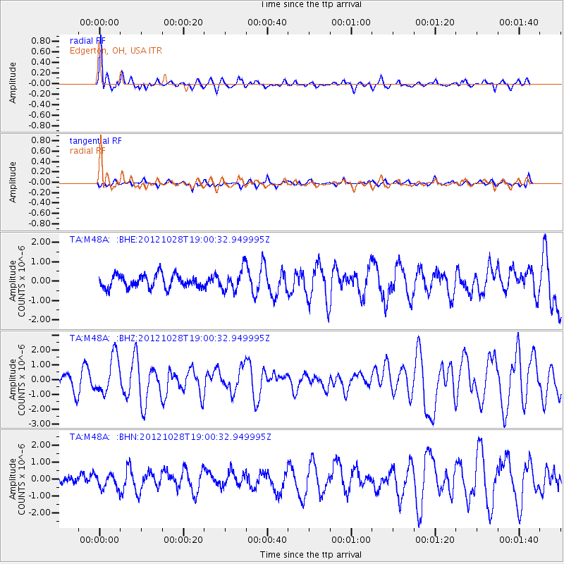
M48A Edgerton, OH, USA - Earthquake Result Viewer
*The percent match for this event was below the threshold and hence no stack was calculated.
| Earthquake location: |
Queen Charlotte Islands Region |
| Earthquake latitude/longitude: |
52.7/-132.6 |
| Earthquake time(UTC): |
2012/10/28 (302) 18:54:20 GMT |
| Earthquake Depth: |
9.0 km |
| Earthquake Magnitude: |
5.9 MB, 6.2 MS, 6.3 MW, 6.3 MW |
| Earthquake Catalog/Contributor: |
WHDF/NEIC |
|
| Network: |
TA USArray Transportable Network (new EarthScope stations) |
| Station: |
M48A Edgerton, OH, USA |
| Lat/Lon: |
41.48 N/84.72 W |
| Elevation: |
258 m |
|
| Distance: |
33.9 deg |
| Az: |
89.778 deg |
| Baz: |
305.86 deg |
| Ray Param: |
$rayparam |
*The percent match for this event was below the threshold and hence was not used in the summary stack. |
|
| Radial Match: |
74.67611 % |
| Radial Bump: |
364 |
| Transverse Match: |
49.018734 % |
| Transverse Bump: |
400 |
| SOD ConfigId: |
478790 |
| Insert Time: |
2013-03-01 09:21:19.602 +0000 |
| GWidth: |
2.5 |
| Max Bumps: |
400 |
| Tol: |
0.001 |
|
Signal To Noise
| Channel | StoN | STA | LTA |
| TA:M48A: :BHZ:20121028T19:00:32.949995Z | 3.0424838 | 1.3166331E-6 | 4.3274943E-7 |
| TA:M48A: :BHN:20121028T19:00:32.949995Z | 1.0712292 | 4.2177766E-7 | 3.9373242E-7 |
| TA:M48A: :BHE:20121028T19:00:32.949995Z | 1.7031988 | 5.761098E-7 | 3.3825165E-7 |
| Arrivals |
| Ps | |
| PpPs | |
| PsPs/PpSs | |


