You are here: Home > Network List > TA - USArray Transportable Network (new EarthScope stations) Stations List
> Station J45A Montague, MI, USA > Earthquake Result Viewer
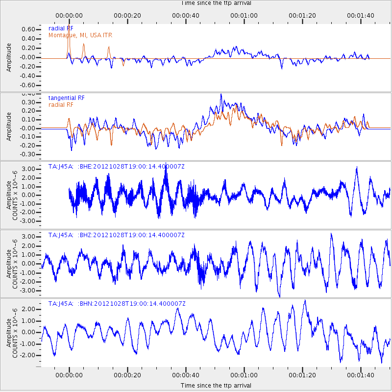
J45A Montague, MI, USA - Earthquake Result Viewer
*The percent match for this event was below the threshold and hence no stack was calculated.
| Earthquake location: |
Queen Charlotte Islands Region |
| Earthquake latitude/longitude: |
52.7/-132.6 |
| Earthquake time(UTC): |
2012/10/28 (302) 18:54:20 GMT |
| Earthquake Depth: |
9.0 km |
| Earthquake Magnitude: |
5.9 MB, 6.2 MS, 6.3 MW, 6.3 MW |
| Earthquake Catalog/Contributor: |
WHDF/NEIC |
|
| Network: |
TA USArray Transportable Network (new EarthScope stations) |
| Station: |
J45A Montague, MI, USA |
| Lat/Lon: |
43.44 N/86.39 W |
| Elevation: |
209 m |
|
| Distance: |
31.7 deg |
| Az: |
88.113 deg |
| Baz: |
303.336 deg |
| Ray Param: |
$rayparam |
*The percent match for this event was below the threshold and hence was not used in the summary stack. |
|
| Radial Match: |
29.408918 % |
| Radial Bump: |
400 |
| Transverse Match: |
44.045094 % |
| Transverse Bump: |
400 |
| SOD ConfigId: |
478790 |
| Insert Time: |
2013-03-01 09:21:54.978 +0000 |
| GWidth: |
2.5 |
| Max Bumps: |
400 |
| Tol: |
0.001 |
|
Signal To Noise
| Channel | StoN | STA | LTA |
| TA:J45A: :BHZ:20121028T19:00:14.400007Z | 1.4600047 | 8.5633786E-7 | 5.8653086E-7 |
| TA:J45A: :BHN:20121028T19:00:14.400007Z | 0.95377624 | 1.2122572E-6 | 1.2710079E-6 |
| TA:J45A: :BHE:20121028T19:00:14.400007Z | 1.5442971 | 1.4011842E-6 | 9.073281E-7 |
| Arrivals |
| Ps | |
| PpPs | |
| PsPs/PpSs | |


