You are here: Home > Network List > TA - USArray Transportable Network (new EarthScope stations) Stations List
> Station O56A Blue Knob State Park, Imler, PA, USA > Earthquake Result Viewer
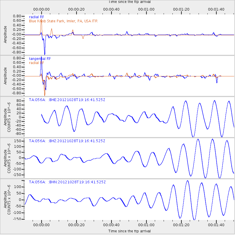
O56A Blue Knob State Park, Imler, PA, USA - Earthquake Result Viewer
*The percent match for this event was below the threshold and hence no stack was calculated.
| Earthquake location: |
Queen Charlotte Islands Region |
| Earthquake latitude/longitude: |
52.3/-132.1 |
| Earthquake time(UTC): |
2012/10/28 (302) 19:09:53 GMT |
| Earthquake Depth: |
10 km |
| Earthquake Magnitude: |
5.6 MB, 5.8 MW, 5.5 MW |
| Earthquake Catalog/Contributor: |
WHDF/NEIC |
|
| Network: |
TA USArray Transportable Network (new EarthScope stations) |
| Station: |
O56A Blue Knob State Park, Imler, PA, USA |
| Lat/Lon: |
40.27 N/78.57 W |
| Elevation: |
684 m |
|
| Distance: |
38.0 deg |
| Az: |
86.615 deg |
| Baz: |
306.748 deg |
| Ray Param: |
$rayparam |
*The percent match for this event was below the threshold and hence was not used in the summary stack. |
|
| Radial Match: |
89.641945 % |
| Radial Bump: |
394 |
| Transverse Match: |
55.3066 % |
| Transverse Bump: |
400 |
| SOD ConfigId: |
478790 |
| Insert Time: |
2013-03-01 09:36:39.529 +0000 |
| GWidth: |
2.5 |
| Max Bumps: |
400 |
| Tol: |
0.001 |
|
Signal To Noise
| Channel | StoN | STA | LTA |
| TA:O56A: :BHZ:20121028T19:16:41.525Z | 1.998978 | 2.3826933E-5 | 1.1919557E-5 |
| TA:O56A: :BHN:20121028T19:16:41.525Z | 0.31344184 | 8.2796405E-6 | 2.6415235E-5 |
| TA:O56A: :BHE:20121028T19:16:41.525Z | 0.50971997 | 1.6662232E-5 | 3.2688993E-5 |
| Arrivals |
| Ps | |
| PpPs | |
| PsPs/PpSs | |


