You are here: Home > Network List > TA - USArray Transportable Network (new EarthScope stations) Stations List
> Station Y43A Makayla and Karen, Gunnison, MS, USA > Earthquake Result Viewer
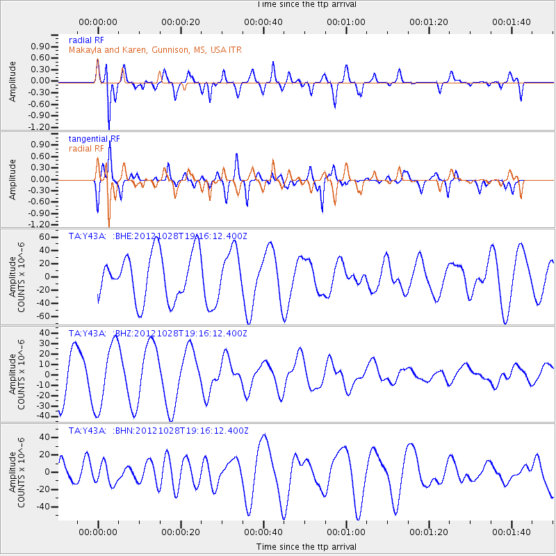
Y43A Makayla and Karen, Gunnison, MS, USA - Earthquake Result Viewer
*The percent match for this event was below the threshold and hence no stack was calculated.
| Earthquake location: |
Queen Charlotte Islands Region |
| Earthquake latitude/longitude: |
52.3/-132.1 |
| Earthquake time(UTC): |
2012/10/28 (302) 19:09:53 GMT |
| Earthquake Depth: |
10 km |
| Earthquake Magnitude: |
5.6 MB, 5.8 MW, 5.5 MW |
| Earthquake Catalog/Contributor: |
WHDF/NEIC |
|
| Network: |
TA USArray Transportable Network (new EarthScope stations) |
| Station: |
Y43A Makayla and Karen, Gunnison, MS, USA |
| Lat/Lon: |
33.91 N/90.93 W |
| Elevation: |
46 m |
|
| Distance: |
34.6 deg |
| Az: |
105.626 deg |
| Baz: |
314.665 deg |
| Ray Param: |
$rayparam |
*The percent match for this event was below the threshold and hence was not used in the summary stack. |
|
| Radial Match: |
77.05485 % |
| Radial Bump: |
400 |
| Transverse Match: |
76.89871 % |
| Transverse Bump: |
400 |
| SOD ConfigId: |
478790 |
| Insert Time: |
2013-03-01 09:38:31.023 +0000 |
| GWidth: |
2.5 |
| Max Bumps: |
400 |
| Tol: |
0.001 |
|
Signal To Noise
| Channel | StoN | STA | LTA |
| TA:Y43A: :BHZ:20121028T19:16:12.400Z | 1.5949894 | 3.091468E-5 | 1.9382373E-5 |
| TA:Y43A: :BHN:20121028T19:16:12.400Z | 0.92724496 | 1.1867276E-5 | 1.2798427E-5 |
| TA:Y43A: :BHE:20121028T19:16:12.400Z | 0.94091046 | 3.2648328E-5 | 3.4698656E-5 |
| Arrivals |
| Ps | |
| PpPs | |
| PsPs/PpSs | |


