You are here: Home > Network List > TA - USArray Transportable Network (new EarthScope stations) Stations List
> Station T47A Sharon Grove, KY, USA > Earthquake Result Viewer
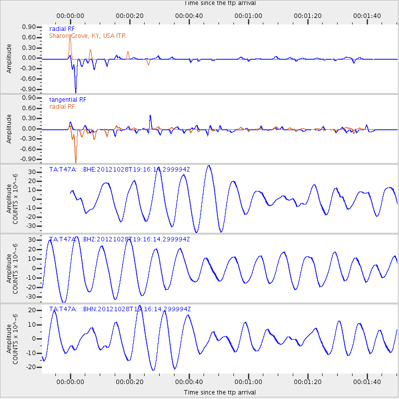
T47A Sharon Grove, KY, USA - Earthquake Result Viewer
*The percent match for this event was below the threshold and hence no stack was calculated.
| Earthquake location: |
Queen Charlotte Islands Region |
| Earthquake latitude/longitude: |
52.3/-132.1 |
| Earthquake time(UTC): |
2012/10/28 (302) 19:09:53 GMT |
| Earthquake Depth: |
10 km |
| Earthquake Magnitude: |
5.6 MB, 5.8 MW, 5.5 MW |
| Earthquake Catalog/Contributor: |
WHDF/NEIC |
|
| Network: |
TA USArray Transportable Network (new EarthScope stations) |
| Station: |
T47A Sharon Grove, KY, USA |
| Lat/Lon: |
36.99 N/87.11 W |
| Elevation: |
217 m |
|
| Distance: |
34.9 deg |
| Az: |
97.952 deg |
| Baz: |
310.564 deg |
| Ray Param: |
$rayparam |
*The percent match for this event was below the threshold and hence was not used in the summary stack. |
|
| Radial Match: |
95.709724 % |
| Radial Bump: |
356 |
| Transverse Match: |
65.67273 % |
| Transverse Bump: |
400 |
| SOD ConfigId: |
478790 |
| Insert Time: |
2013-03-01 09:41:06.126 +0000 |
| GWidth: |
2.5 |
| Max Bumps: |
400 |
| Tol: |
0.001 |
|
Signal To Noise
| Channel | StoN | STA | LTA |
| TA:T47A: :BHZ:20121028T19:16:14.299994Z | 1.1108662 | 2.1563206E-5 | 1.9411165E-5 |
| TA:T47A: :BHN:20121028T19:16:14.299994Z | 0.46318915 | 5.407043E-6 | 1.1673509E-5 |
| TA:T47A: :BHE:20121028T19:16:14.299994Z | 1.942681 | 2.49182E-5 | 1.28267075E-5 |
| Arrivals |
| Ps | |
| PpPs | |
| PsPs/PpSs | |


