You are here: Home > Network List > UW - Pacific Northwest Regional Seismic Network Stations List
> Station UMAT Pilot Rock, OR, USA > Earthquake Result Viewer
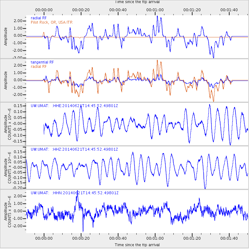
UMAT Pilot Rock, OR, USA - Earthquake Result Viewer
*The percent match for this event was below the threshold and hence no stack was calculated.
| Earthquake location: |
Laptev Sea |
| Earthquake latitude/longitude: |
74.8/134.0 |
| Earthquake time(UTC): |
2014/06/21 (172) 14:37:21 GMT |
| Earthquake Depth: |
10 km |
| Earthquake Magnitude: |
3.6 mb |
| Earthquake Catalog/Contributor: |
ISC/ISC |
|
| Network: |
UW Pacific Northwest Regional Seismic Network |
| Station: |
UMAT Pilot Rock, OR, USA |
| Lat/Lon: |
45.29 N/118.96 W |
| Elevation: |
1318 m |
|
| Distance: |
51.0 deg |
| Az: |
60.249 deg |
| Baz: |
341.101 deg |
| Ray Param: |
$rayparam |
*The percent match for this event was below the threshold and hence was not used in the summary stack. |
|
| Radial Match: |
34.22394 % |
| Radial Bump: |
400 |
| Transverse Match: |
41.40874 % |
| Transverse Bump: |
400 |
| SOD ConfigId: |
3390531 |
| Insert Time: |
2019-04-12 09:25:12.868 +0000 |
| GWidth: |
2.5 |
| Max Bumps: |
400 |
| Tol: |
0.001 |
|
Signal To Noise
| Channel | StoN | STA | LTA |
| UW:UMAT: :HHZ:20140621T14:45:52.49801Z | 0.73267037 | 5.3458855E-8 | 7.2964404E-8 |
| UW:UMAT: :HHN:20140621T14:45:52.49801Z | 1.2052023 | 6.300396E-7 | 5.227667E-7 |
| UW:UMAT: :HHE:20140621T14:45:52.49801Z | 0.98589426 | 6.912557E-8 | 7.011459E-8 |
| Arrivals |
| Ps | |
| PpPs | |
| PsPs/PpSs | |


