You are here: Home > Network List > G - GEOSCOPE Stations List
> Station WUS Wushi, Xinjiang Uygur, China > Earthquake Result Viewer
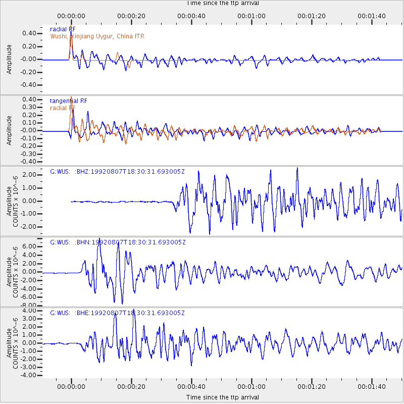
WUS Wushi, Xinjiang Uygur, China - Earthquake Result Viewer
*The percent match for this event was below the threshold and hence no stack was calculated.
| Earthquake location: |
Gulf Of Alaska |
| Earthquake latitude/longitude: |
57.6/-143.0 |
| Earthquake time(UTC): |
1992/08/07 (220) 18:19:19 GMT |
| Earthquake Depth: |
10 km |
| Earthquake Magnitude: |
6.3 MB, 6.5 MS, 6.5 ML |
| Earthquake Catalog/Contributor: |
WHDF/NEIC |
|
| Network: |
G GEOSCOPE |
| Station: |
WUS Wushi, Xinjiang Uygur, China |
| Lat/Lon: |
41.20 N/79.22 E |
| Elevation: |
1457 m |
|
| Distance: |
75.4 deg |
| Az: |
328.367 deg |
| Baz: |
21.972 deg |
| Ray Param: |
$rayparam |
*The percent match for this event was below the threshold and hence was not used in the summary stack. |
|
| Radial Match: |
92.03881 % |
| Radial Bump: |
400 |
| Transverse Match: |
91.617676 % |
| Transverse Bump: |
400 |
| SOD ConfigId: |
4480 |
| Insert Time: |
2010-02-27 01:09:47.638 +0000 |
| GWidth: |
2.5 |
| Max Bumps: |
400 |
| Tol: |
0.001 |
|
Signal To Noise
| Channel | StoN | STA | LTA |
| G:WUS: :BHN:19920807T18:30:31.693005Z | 21.610056 | 1.0447784E-6 | 4.8346866E-8 |
| G:WUS: :BHE:19920807T18:30:31.693005Z | 4.0796533 | 3.3342084E-7 | 8.172774E-8 |
| G:WUS: :BHZ:19920807T18:30:31.693005Z | 7.0857806 | 1.8690716E-7 | 2.637778E-8 |
| Arrivals |
| Ps | |
| PpPs | |
| PsPs/PpSs | |


