You are here: Home > Network List > KN - Kyrgyz Seismic Telemetry Network Stations List
> Station CHM KN.CHM > Earthquake Result Viewer
CHM KN.CHM - Earthquake Result Viewer
*The percent match for this event was below the threshold and hence no stack was calculated.
| Earthquake location: |
Minahassa Peninsula, Sulawesi |
| Earthquake latitude/longitude: |
-0.1/123.0 |
| Earthquake time(UTC): |
2014/06/21 (172) 21:51:51 GMT |
| Earthquake Depth: |
115 km |
| Earthquake Magnitude: |
5.5 MB |
| Earthquake Catalog/Contributor: |
NEIC PDE/NEIC COMCAT |
|
| Network: |
KN Kyrgyz Seismic Telemetry Network |
| Station: |
CHM KN.CHM |
| Lat/Lon: |
43.00 N/74.75 E |
| Elevation: |
655 m |
|
| Distance: |
60.9 deg |
| Az: |
321.197 deg |
| Baz: |
121.335 deg |
| Ray Param: |
$rayparam |
*The percent match for this event was below the threshold and hence was not used in the summary stack. |
|
| Radial Match: |
17.492367 % |
| Radial Bump: |
400 |
| Transverse Match: |
9.888983 % |
| Transverse Bump: |
400 |
| SOD ConfigId: |
3390531 |
| Insert Time: |
2019-04-12 09:28:44.904 +0000 |
| GWidth: |
2.5 |
| Max Bumps: |
400 |
| Tol: |
0.001 |
|
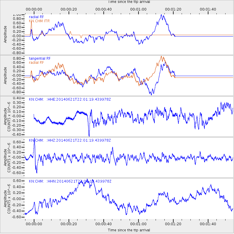
Signal To Noise
| Channel | StoN | STA | LTA |
| KN:CHM: :HHZ:20140621T22:01:19.439978Z | 9.541673 | 3.1039255E-7 | 3.2530203E-8 |
| KN:CHM: :HHN:20140621T22:01:19.439978Z | 0.6477095 | 3.970395E-7 | 6.1299005E-7 |
| KN:CHM: :HHE:20140621T22:01:19.439978Z | 1.9414103 | 1.40726E-7 | 7.2486486E-8 |
| Arrivals |
| Ps | |
| PpPs | |
| PsPs/PpSs | |


