You are here: Home > Network List > TA - USArray Transportable Network (new EarthScope stations) Stations List
> Station X44A Crenshaw, MS, USA > Earthquake Result Viewer
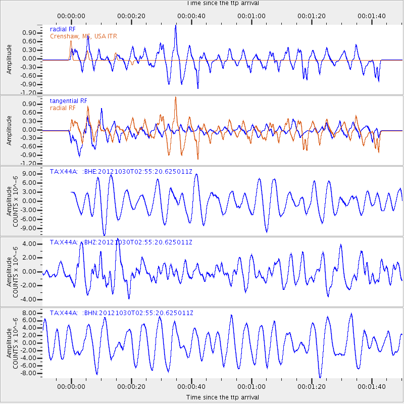
X44A Crenshaw, MS, USA - Earthquake Result Viewer
*The percent match for this event was below the threshold and hence no stack was calculated.
| Earthquake location: |
Queen Charlotte Islands Region |
| Earthquake latitude/longitude: |
52.4/-131.9 |
| Earthquake time(UTC): |
2012/10/30 (304) 02:49:02 GMT |
| Earthquake Depth: |
9.0 km |
| Earthquake Magnitude: |
5.8 MB, 6.0 MS, 6.2 MW, 6.2 MW |
| Earthquake Catalog/Contributor: |
WHDF/NEIC |
|
| Network: |
TA USArray Transportable Network (new EarthScope stations) |
| Station: |
X44A Crenshaw, MS, USA |
| Lat/Lon: |
34.50 N/90.15 W |
| Elevation: |
109 m |
|
| Distance: |
34.6 deg |
| Az: |
104.374 deg |
| Baz: |
314.01 deg |
| Ray Param: |
$rayparam |
*The percent match for this event was below the threshold and hence was not used in the summary stack. |
|
| Radial Match: |
62.359577 % |
| Radial Bump: |
396 |
| Transverse Match: |
59.584644 % |
| Transverse Bump: |
383 |
| SOD ConfigId: |
478790 |
| Insert Time: |
2013-03-01 10:08:05.062 +0000 |
| GWidth: |
2.5 |
| Max Bumps: |
400 |
| Tol: |
0.001 |
|
Signal To Noise
| Channel | StoN | STA | LTA |
| TA:X44A: :BHZ:20121030T02:55:20.625011Z | 2.52926 | 2.1713347E-6 | 8.5848615E-7 |
| TA:X44A: :BHN:20121030T02:55:20.625011Z | 0.6768479 | 2.5510049E-6 | 3.7689488E-6 |
| TA:X44A: :BHE:20121030T02:55:20.625011Z | 1.0491663 | 4.419225E-6 | 4.2121305E-6 |
| Arrivals |
| Ps | |
| PpPs | |
| PsPs/PpSs | |


