You are here: Home > Network List > TA - USArray Transportable Network (new EarthScope stations) Stations List
> Station U41A Viola, AR, USA > Earthquake Result Viewer
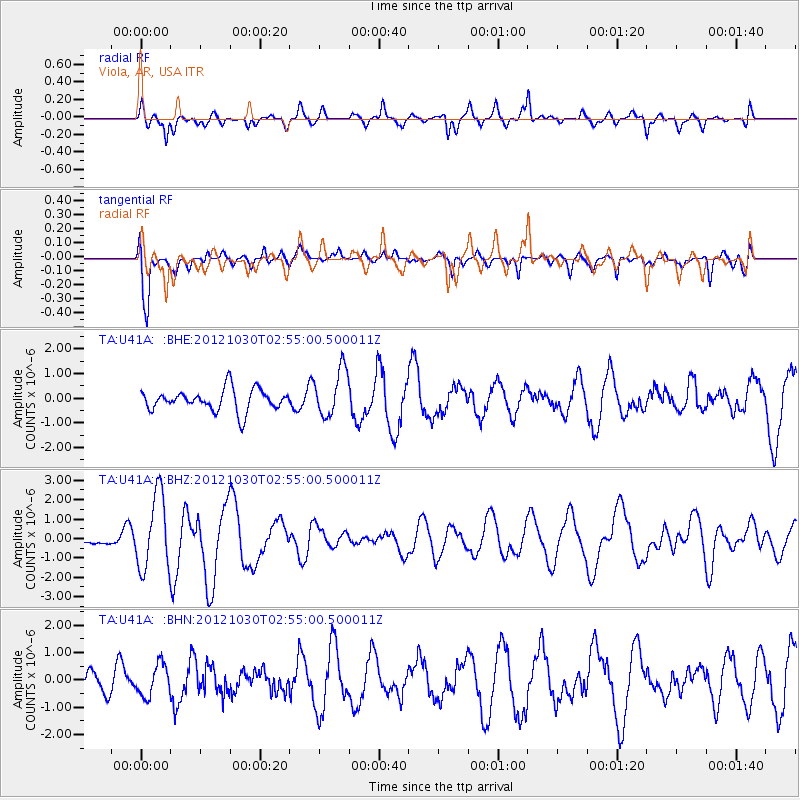
U41A Viola, AR, USA - Earthquake Result Viewer
*The percent match for this event was below the threshold and hence no stack was calculated.
| Earthquake location: |
Queen Charlotte Islands Region |
| Earthquake latitude/longitude: |
52.4/-131.9 |
| Earthquake time(UTC): |
2012/10/30 (304) 02:49:02 GMT |
| Earthquake Depth: |
9.0 km |
| Earthquake Magnitude: |
5.8 MB, 6.0 MS, 6.2 MW, 6.2 MW |
| Earthquake Catalog/Contributor: |
WHDF/NEIC |
|
| Network: |
TA USArray Transportable Network (new EarthScope stations) |
| Station: |
U41A Viola, AR, USA |
| Lat/Lon: |
36.34 N/91.92 W |
| Elevation: |
300 m |
|
| Distance: |
32.3 deg |
| Az: |
103.742 deg |
| Baz: |
312.459 deg |
| Ray Param: |
$rayparam |
*The percent match for this event was below the threshold and hence was not used in the summary stack. |
|
| Radial Match: |
65.08506 % |
| Radial Bump: |
379 |
| Transverse Match: |
71.794624 % |
| Transverse Bump: |
400 |
| SOD ConfigId: |
478790 |
| Insert Time: |
2013-03-01 10:08:30.667 +0000 |
| GWidth: |
2.5 |
| Max Bumps: |
400 |
| Tol: |
0.001 |
|
Signal To Noise
| Channel | StoN | STA | LTA |
| TA:U41A: :BHZ:20121030T02:55:00.500011Z | 3.4604385 | 1.937143E-6 | 5.5979694E-7 |
| TA:U41A: :BHN:20121030T02:55:00.500011Z | 0.9218052 | 5.8374246E-7 | 6.3326013E-7 |
| TA:U41A: :BHE:20121030T02:55:00.500011Z | 2.1822505 | 9.530869E-7 | 4.3674493E-7 |
| Arrivals |
| Ps | |
| PpPs | |
| PsPs/PpSs | |


