You are here: Home > Network List > TA - USArray Transportable Network (new EarthScope stations) Stations List
> Station N44A Piper City, IL, USA > Earthquake Result Viewer
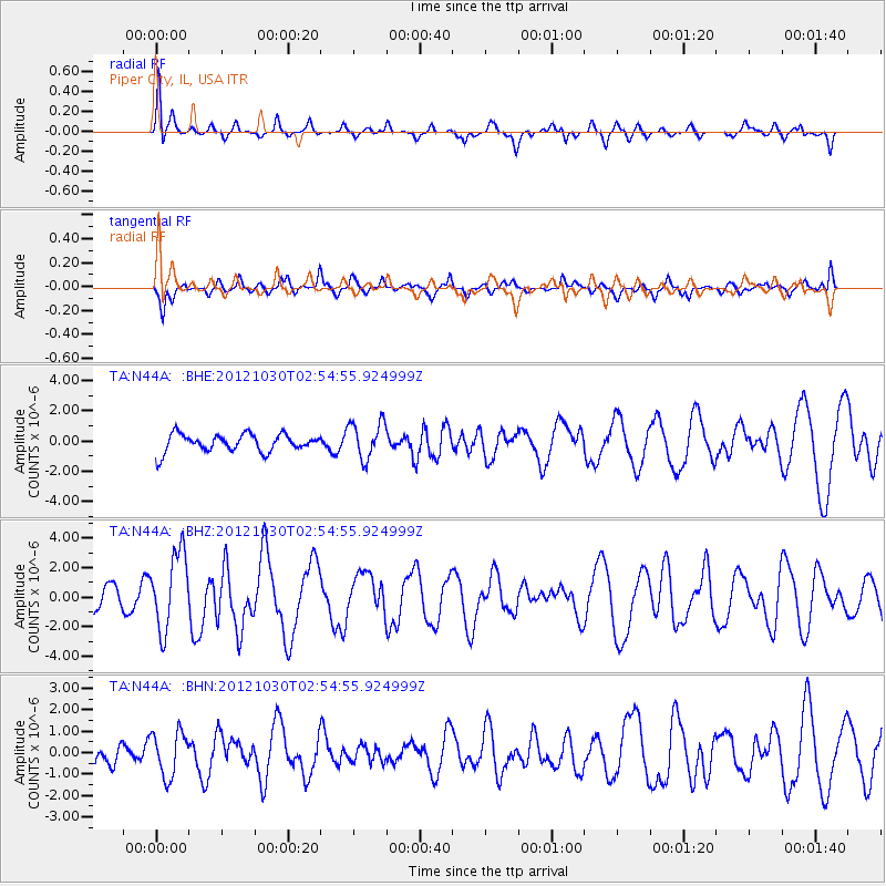
N44A Piper City, IL, USA - Earthquake Result Viewer
*The percent match for this event was below the threshold and hence no stack was calculated.
| Earthquake location: |
Queen Charlotte Islands Region |
| Earthquake latitude/longitude: |
52.4/-131.9 |
| Earthquake time(UTC): |
2012/10/30 (304) 02:49:02 GMT |
| Earthquake Depth: |
9.0 km |
| Earthquake Magnitude: |
5.8 MB, 6.0 MS, 6.2 MW, 6.2 MW |
| Earthquake Catalog/Contributor: |
WHDF/NEIC |
|
| Network: |
TA USArray Transportable Network (new EarthScope stations) |
| Station: |
N44A Piper City, IL, USA |
| Lat/Lon: |
40.80 N/88.13 W |
| Elevation: |
202 m |
|
| Distance: |
31.8 deg |
| Az: |
93.703 deg |
| Baz: |
306.294 deg |
| Ray Param: |
$rayparam |
*The percent match for this event was below the threshold and hence was not used in the summary stack. |
|
| Radial Match: |
70.3883 % |
| Radial Bump: |
330 |
| Transverse Match: |
65.552734 % |
| Transverse Bump: |
400 |
| SOD ConfigId: |
478790 |
| Insert Time: |
2013-03-01 10:08:54.967 +0000 |
| GWidth: |
2.5 |
| Max Bumps: |
400 |
| Tol: |
0.001 |
|
Signal To Noise
| Channel | StoN | STA | LTA |
| TA:N44A: :BHZ:20121030T02:54:55.924999Z | 2.7610753 | 2.5932993E-6 | 9.392353E-7 |
| TA:N44A: :BHN:20121030T02:54:55.924999Z | 1.1568373 | 1.0409467E-6 | 8.9982115E-7 |
| TA:N44A: :BHE:20121030T02:54:55.924999Z | 2.1190338 | 1.2302638E-6 | 5.805777E-7 |
| Arrivals |
| Ps | |
| PpPs | |
| PsPs/PpSs | |


