You are here: Home > Network List > UW - Pacific Northwest Regional Seismic Network Stations List
> Station PASS Maple Falls, WA, USA > Earthquake Result Viewer
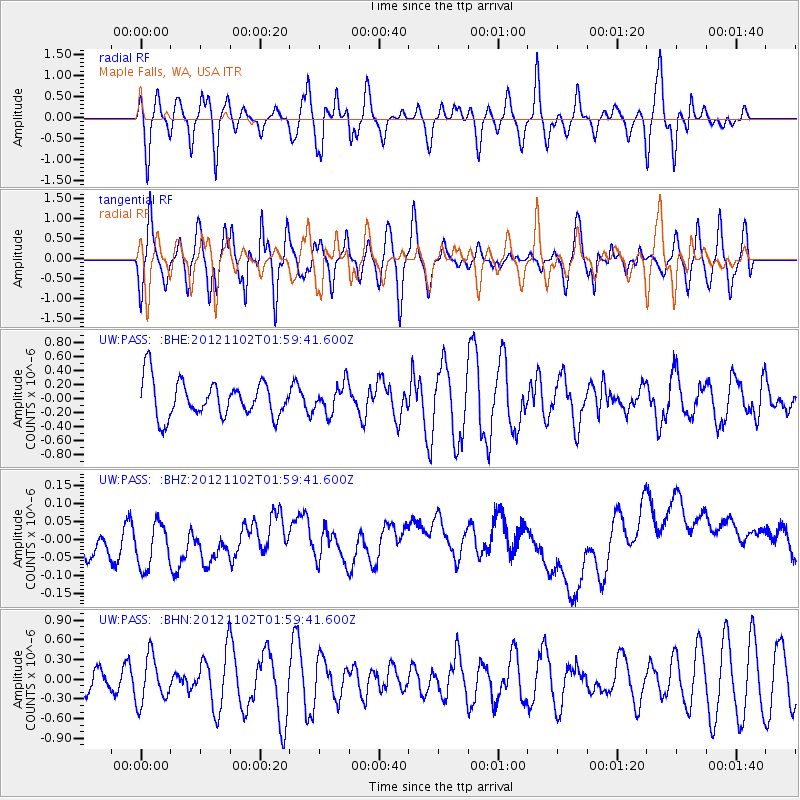
PASS Maple Falls, WA, USA - Earthquake Result Viewer
*The percent match for this event was below the threshold and hence no stack was calculated.
| Earthquake location: |
Near East Coast Of Kamchatka |
| Earthquake latitude/longitude: |
55.9/162.8 |
| Earthquake time(UTC): |
2012/11/02 (307) 01:52:03 GMT |
| Earthquake Depth: |
9.1 km |
| Earthquake Magnitude: |
5.5 MB, 5.4 MS, 5.5 MW, 5.6 MW |
| Earthquake Catalog/Contributor: |
WHDF/NEIC |
|
| Network: |
UW Pacific Northwest Regional Seismic Network |
| Station: |
PASS Maple Falls, WA, USA |
| Lat/Lon: |
49.00 N/122.09 W |
| Elevation: |
174 m |
|
| Distance: |
44.2 deg |
| Az: |
65.938 deg |
| Baz: |
308.634 deg |
| Ray Param: |
$rayparam |
*The percent match for this event was below the threshold and hence was not used in the summary stack. |
|
| Radial Match: |
53.387268 % |
| Radial Bump: |
400 |
| Transverse Match: |
56.959385 % |
| Transverse Bump: |
400 |
| SOD ConfigId: |
478790 |
| Insert Time: |
2013-03-01 10:32:57.011 +0000 |
| GWidth: |
2.5 |
| Max Bumps: |
400 |
| Tol: |
0.001 |
|
Signal To Noise
| Channel | StoN | STA | LTA |
| UW:PASS: :BHZ:20121102T01:59:41.600Z | 1.5180206 | 8.9618304E-8 | 5.903629E-8 |
| UW:PASS: :BHN:20121102T01:59:41.600Z | 1.4421754 | 3.550996E-7 | 2.4622497E-7 |
| UW:PASS: :BHE:20121102T01:59:41.600Z | 0.8005562 | 2.0651976E-7 | 2.5797036E-7 |
| Arrivals |
| Ps | |
| PpPs | |
| PsPs/PpSs | |


