You are here: Home > Network List > CN - Canadian National Seismograph Network Stations List
> Station INK INUVIK, NT > Earthquake Result Viewer
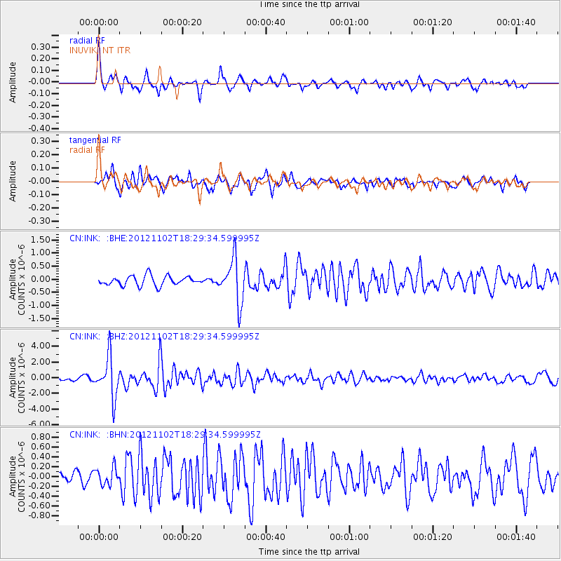
INK INUVIK, NT - Earthquake Result Viewer
*The percent match for this event was below the threshold and hence no stack was calculated.
| Earthquake location: |
Mindanao, Philippines |
| Earthquake latitude/longitude: |
9.2/126.2 |
| Earthquake time(UTC): |
2012/11/02 (307) 18:17:32 GMT |
| Earthquake Depth: |
37 km |
| Earthquake Magnitude: |
6.2 MB, 5.7 MS, 6.1 MW, 6.1 MW |
| Earthquake Catalog/Contributor: |
WHDF/NEIC |
|
| Network: |
CN Canadian National Seismograph Network |
| Station: |
INK INUVIK, NT |
| Lat/Lon: |
68.31 N/133.53 W |
| Elevation: |
44 m |
|
| Distance: |
85.3 deg |
| Az: |
21.532 deg |
| Baz: |
282.945 deg |
| Ray Param: |
$rayparam |
*The percent match for this event was below the threshold and hence was not used in the summary stack. |
|
| Radial Match: |
75.78865 % |
| Radial Bump: |
400 |
| Transverse Match: |
75.450554 % |
| Transverse Bump: |
400 |
| SOD ConfigId: |
478790 |
| Insert Time: |
2013-03-01 10:38:10.366 +0000 |
| GWidth: |
2.5 |
| Max Bumps: |
400 |
| Tol: |
0.001 |
|
Signal To Noise
| Channel | StoN | STA | LTA |
| CN:INK: :BHZ:20121102T18:29:34.599995Z | 16.130566 | 2.6696237E-6 | 1.6550094E-7 |
| CN:INK: :BHN:20121102T18:29:34.599995Z | 1.2860835 | 1.8670744E-7 | 1.451752E-7 |
| CN:INK: :BHE:20121102T18:29:34.599995Z | 4.7985497 | 8.703774E-7 | 1.8138341E-7 |
| Arrivals |
| Ps | |
| PpPs | |
| PsPs/PpSs | |


