You are here: Home > Network List > GS - US Geological Survey Networks Stations List
> Station KAN10 Keim Farm > Earthquake Result Viewer
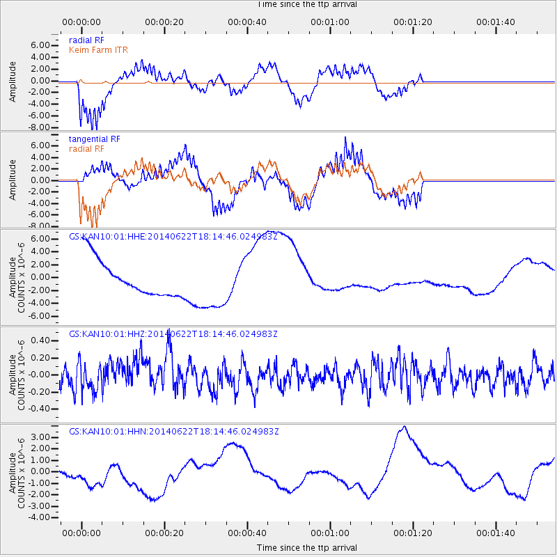
KAN10 Keim Farm - Earthquake Result Viewer
*The percent match for this event was below the threshold and hence no stack was calculated.
| Earthquake location: |
Central Peru |
| Earthquake latitude/longitude: |
-13.8/-75.6 |
| Earthquake time(UTC): |
2014/06/22 (173) 18:05:53 GMT |
| Earthquake Depth: |
72 km |
| Earthquake Magnitude: |
5.2 MW |
| Earthquake Catalog/Contributor: |
ISC/ISC |
|
| Network: |
GS US Geological Survey Networks |
| Station: |
KAN10 Keim Farm |
| Lat/Lon: |
37.12 N/98.10 W |
| Elevation: |
417 m |
|
| Distance: |
54.9 deg |
| Az: |
338.042 deg |
| Baz: |
152.965 deg |
| Ray Param: |
$rayparam |
*The percent match for this event was below the threshold and hence was not used in the summary stack. |
|
| Radial Match: |
70.81134 % |
| Radial Bump: |
400 |
| Transverse Match: |
61.666824 % |
| Transverse Bump: |
379 |
| SOD ConfigId: |
3390531 |
| Insert Time: |
2019-04-12 09:36:47.855 +0000 |
| GWidth: |
2.5 |
| Max Bumps: |
400 |
| Tol: |
0.001 |
|
Signal To Noise
| Channel | StoN | STA | LTA |
| GS:KAN10:01:HHZ:20140622T18:14:46.024983Z | 1.4335928 | 1.5819617E-7 | 1.1034945E-7 |
| GS:KAN10:01:HHN:20140622T18:14:46.024983Z | 0.64998 | 3.66858E-6 | 5.6441427E-6 |
| GS:KAN10:01:HHE:20140622T18:14:46.024983Z | 1.488833 | 4.2417755E-6 | 2.8490608E-6 |
| Arrivals |
| Ps | |
| PpPs | |
| PsPs/PpSs | |


