You are here: Home > Network List > UW - Pacific Northwest Regional Seismic Network Stations List
> Station LEBA Lebam, WA, USA > Earthquake Result Viewer
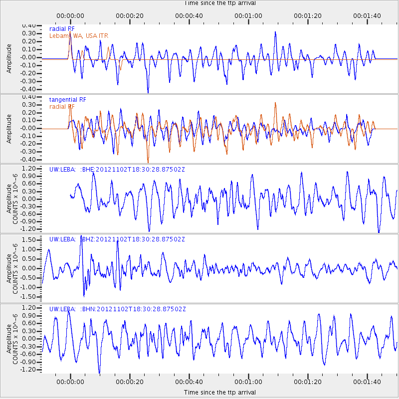
LEBA Lebam, WA, USA - Earthquake Result Viewer
*The percent match for this event was below the threshold and hence no stack was calculated.
| Earthquake location: |
Mindanao, Philippines |
| Earthquake latitude/longitude: |
9.2/126.2 |
| Earthquake time(UTC): |
2012/11/02 (307) 18:17:32 GMT |
| Earthquake Depth: |
37 km |
| Earthquake Magnitude: |
6.2 MB, 5.7 MS, 6.1 MW, 6.1 MW |
| Earthquake Catalog/Contributor: |
WHDF/NEIC |
|
| Network: |
UW Pacific Northwest Regional Seismic Network |
| Station: |
LEBA Lebam, WA, USA |
| Lat/Lon: |
46.55 N/123.56 W |
| Elevation: |
73 m |
|
| Distance: |
96.9 deg |
| Az: |
40.71 deg |
| Baz: |
291.104 deg |
| Ray Param: |
$rayparam |
*The percent match for this event was below the threshold and hence was not used in the summary stack. |
|
| Radial Match: |
58.957203 % |
| Radial Bump: |
400 |
| Transverse Match: |
63.058075 % |
| Transverse Bump: |
400 |
| SOD ConfigId: |
478790 |
| Insert Time: |
2013-03-01 10:42:19.973 +0000 |
| GWidth: |
2.5 |
| Max Bumps: |
400 |
| Tol: |
0.001 |
|
Signal To Noise
| Channel | StoN | STA | LTA |
| UW:LEBA: :BHZ:20121102T18:30:28.87502Z | 1.6646101 | 7.015906E-7 | 4.214744E-7 |
| UW:LEBA: :BHN:20121102T18:30:28.87502Z | 1.7059187 | 6.1087127E-7 | 3.5808932E-7 |
| UW:LEBA: :BHE:20121102T18:30:28.87502Z | 1.3177077 | 5.1363673E-7 | 3.8979564E-7 |
| Arrivals |
| Ps | |
| PpPs | |
| PsPs/PpSs | |


