You are here: Home > Network List > TA - USArray Transportable Network (new EarthScope stations) Stations List
> Station O48A Farmland, IN, USA > Earthquake Result Viewer
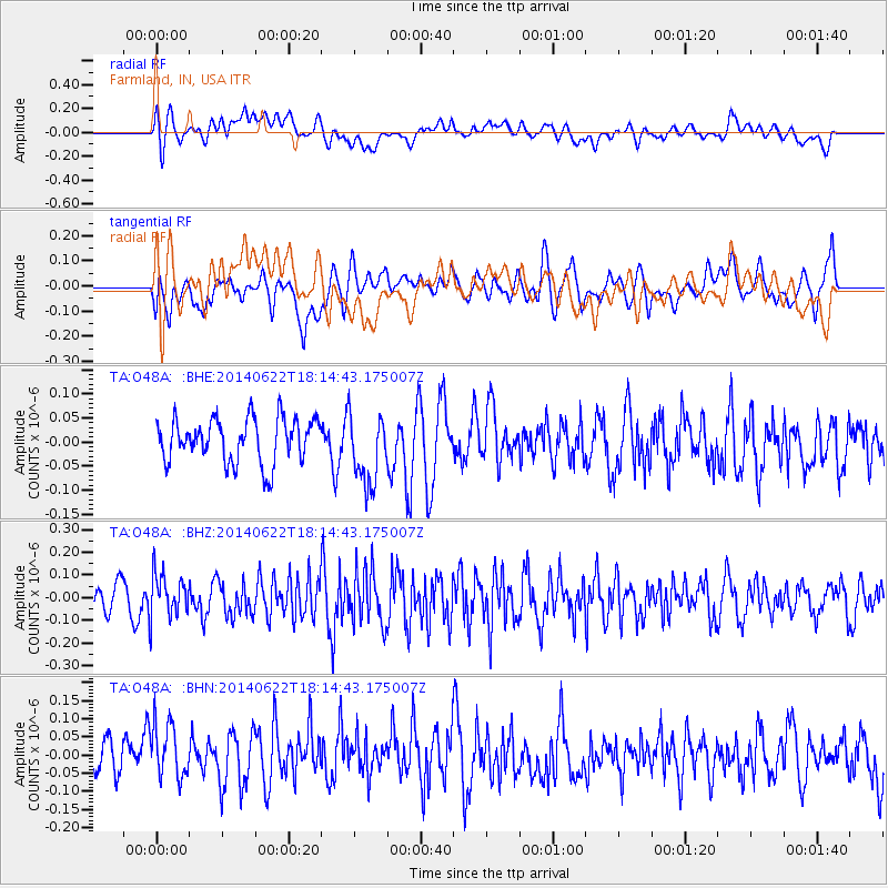
O48A Farmland, IN, USA - Earthquake Result Viewer
*The percent match for this event was below the threshold and hence no stack was calculated.
| Earthquake location: |
Central Peru |
| Earthquake latitude/longitude: |
-13.8/-75.6 |
| Earthquake time(UTC): |
2014/06/22 (173) 18:05:53 GMT |
| Earthquake Depth: |
72 km |
| Earthquake Magnitude: |
5.2 MW |
| Earthquake Catalog/Contributor: |
ISC/ISC |
|
| Network: |
TA USArray Transportable Network (new EarthScope stations) |
| Station: |
O48A Farmland, IN, USA |
| Lat/Lon: |
40.26 N/85.16 W |
| Elevation: |
300 m |
|
| Distance: |
54.5 deg |
| Az: |
351.017 deg |
| Baz: |
168.567 deg |
| Ray Param: |
$rayparam |
*The percent match for this event was below the threshold and hence was not used in the summary stack. |
|
| Radial Match: |
50.29427 % |
| Radial Bump: |
400 |
| Transverse Match: |
62.67414 % |
| Transverse Bump: |
400 |
| SOD ConfigId: |
3390531 |
| Insert Time: |
2019-04-12 09:40:21.812 +0000 |
| GWidth: |
2.5 |
| Max Bumps: |
400 |
| Tol: |
0.001 |
|
Signal To Noise
| Channel | StoN | STA | LTA |
| TA:O48A: :BHZ:20140622T18:14:43.175007Z | 1.0679452 | 9.674385E-8 | 9.058878E-8 |
| TA:O48A: :BHN:20140622T18:14:43.175007Z | 1.600659 | 8.565781E-8 | 5.351409E-8 |
| TA:O48A: :BHE:20140622T18:14:43.175007Z | 1.6121026 | 7.354562E-8 | 4.5620933E-8 |
| Arrivals |
| Ps | |
| PpPs | |
| PsPs/PpSs | |


