You are here: Home > Network List > TA - USArray Transportable Network (new EarthScope stations) Stations List
> Station H17A Grant Village (NPS), Yellowstone Nt. Park, WY, USA > Earthquake Result Viewer
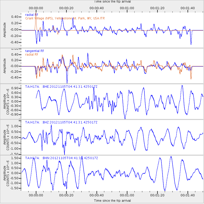
H17A Grant Village (NPS), Yellowstone Nt. Park, WY, USA - Earthquake Result Viewer
*The percent match for this event was below the threshold and hence no stack was calculated.
| Earthquake location: |
Off East Coast Of Honshu, Japan |
| Earthquake latitude/longitude: |
37.8/143.6 |
| Earthquake time(UTC): |
2012/11/05 (310) 04:30:26 GMT |
| Earthquake Depth: |
19 km |
| Earthquake Magnitude: |
5.7 MB, 5.2 MS, 5.6 MW, 5.6 MW |
| Earthquake Catalog/Contributor: |
WHDF/NEIC |
|
| Network: |
TA USArray Transportable Network (new EarthScope stations) |
| Station: |
H17A Grant Village (NPS), Yellowstone Nt. Park, WY, USA |
| Lat/Lon: |
44.40 N/110.58 W |
| Elevation: |
2400 m |
|
| Distance: |
74.3 deg |
| Az: |
45.765 deg |
| Baz: |
307.645 deg |
| Ray Param: |
$rayparam |
*The percent match for this event was below the threshold and hence was not used in the summary stack. |
|
| Radial Match: |
53.778667 % |
| Radial Bump: |
400 |
| Transverse Match: |
59.48811 % |
| Transverse Bump: |
348 |
| SOD ConfigId: |
486604 |
| Insert Time: |
2013-03-08 04:27:40.061 +0000 |
| GWidth: |
2.5 |
| Max Bumps: |
400 |
| Tol: |
0.001 |
|
Signal To Noise
| Channel | StoN | STA | LTA |
| TA:H17A: :BHZ:20121105T04:41:31.425017Z | 1.6959858 | 4.0949544E-7 | 2.414498E-7 |
| TA:H17A: :BHN:20121105T04:41:31.425017Z | 1.7371613 | 9.119766E-7 | 5.24981E-7 |
| TA:H17A: :BHE:20121105T04:41:31.425017Z | 0.47451797 | 2.1840495E-7 | 4.6026696E-7 |
| Arrivals |
| Ps | |
| PpPs | |
| PsPs/PpSs | |


