You are here: Home > Network List > TA - USArray Transportable Network (new EarthScope stations) Stations List
> Station G42A Mountain, WI, USA > Earthquake Result Viewer
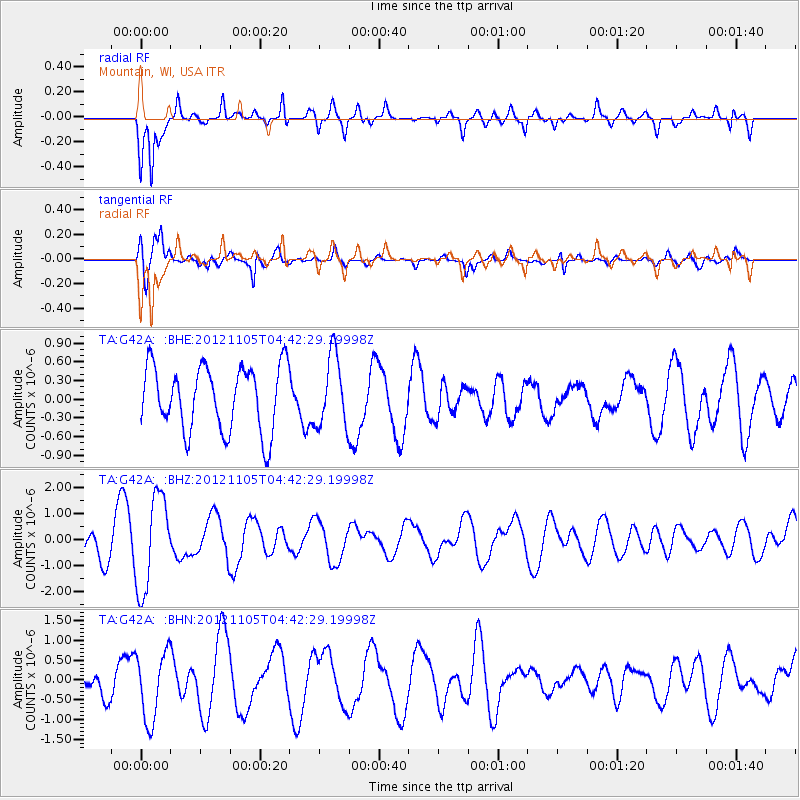
G42A Mountain, WI, USA - Earthquake Result Viewer
*The percent match for this event was below the threshold and hence no stack was calculated.
| Earthquake location: |
Off East Coast Of Honshu, Japan |
| Earthquake latitude/longitude: |
37.8/143.6 |
| Earthquake time(UTC): |
2012/11/05 (310) 04:30:26 GMT |
| Earthquake Depth: |
19 km |
| Earthquake Magnitude: |
5.7 MB, 5.2 MS, 5.6 MW, 5.6 MW |
| Earthquake Catalog/Contributor: |
WHDF/NEIC |
|
| Network: |
TA USArray Transportable Network (new EarthScope stations) |
| Station: |
G42A Mountain, WI, USA |
| Lat/Lon: |
45.24 N/88.43 W |
| Elevation: |
315 m |
|
| Distance: |
85.0 deg |
| Az: |
33.998 deg |
| Baz: |
321.169 deg |
| Ray Param: |
$rayparam |
*The percent match for this event was below the threshold and hence was not used in the summary stack. |
|
| Radial Match: |
83.2238 % |
| Radial Bump: |
397 |
| Transverse Match: |
68.55513 % |
| Transverse Bump: |
400 |
| SOD ConfigId: |
486604 |
| Insert Time: |
2013-03-08 04:31:27.115 +0000 |
| GWidth: |
2.5 |
| Max Bumps: |
400 |
| Tol: |
0.001 |
|
Signal To Noise
| Channel | StoN | STA | LTA |
| TA:G42A: :BHZ:20121105T04:42:29.19998Z | 2.339379 | 1.8169711E-6 | 7.7668955E-7 |
| TA:G42A: :BHN:20121105T04:42:29.19998Z | 2.7829459 | 8.6267073E-7 | 3.0998473E-7 |
| TA:G42A: :BHE:20121105T04:42:29.19998Z | 1.1023812 | 5.717319E-7 | 5.1863356E-7 |
| Arrivals |
| Ps | |
| PpPs | |
| PsPs/PpSs | |


