You are here: Home > Network List > G - GEOSCOPE Stations List
> Station FOMA Nahampoana reservation, Fort Dauphin, Madagascar > Earthquake Result Viewer
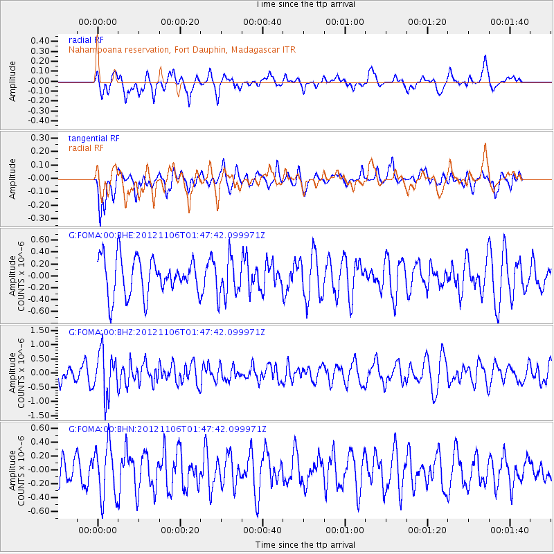
FOMA Nahampoana reservation, Fort Dauphin, Madagascar - Earthquake Result Viewer
*The percent match for this event was below the threshold and hence no stack was calculated.
| Earthquake location: |
Minahassa Peninsula, Sulawesi |
| Earthquake latitude/longitude: |
1.4/122.2 |
| Earthquake time(UTC): |
2012/11/06 (311) 01:36:21 GMT |
| Earthquake Depth: |
25 km |
| Earthquake Magnitude: |
5.7 MB, 5.2 MS, 5.7 MW, 5.6 MW |
| Earthquake Catalog/Contributor: |
WHDF/NEIC |
|
| Network: |
G GEOSCOPE |
| Station: |
FOMA Nahampoana reservation, Fort Dauphin, Madagascar |
| Lat/Lon: |
24.98 S/46.98 E |
| Elevation: |
26 m |
|
| Distance: |
77.2 deg |
| Az: |
244.143 deg |
| Baz: |
82.416 deg |
| Ray Param: |
$rayparam |
*The percent match for this event was below the threshold and hence was not used in the summary stack. |
|
| Radial Match: |
60.798195 % |
| Radial Bump: |
400 |
| Transverse Match: |
57.006817 % |
| Transverse Bump: |
400 |
| SOD ConfigId: |
486604 |
| Insert Time: |
2013-03-08 04:40:37.198 +0000 |
| GWidth: |
2.5 |
| Max Bumps: |
400 |
| Tol: |
0.001 |
|
Signal To Noise
| Channel | StoN | STA | LTA |
| G:FOMA:00:BHZ:20121106T01:47:42.099971Z | 2.0256727 | 7.617197E-7 | 3.76033E-7 |
| G:FOMA:00:BHN:20121106T01:47:42.099971Z | 2.1401267 | 3.8433805E-7 | 1.7958658E-7 |
| G:FOMA:00:BHE:20121106T01:47:42.099971Z | 1.0858423 | 3.4135488E-7 | 3.1436875E-7 |
| Arrivals |
| Ps | |
| PpPs | |
| PsPs/PpSs | |


