You are here: Home > Network List > IU - Global Seismograph Network (GSN - IRIS/USGS) Stations List
> Station GRFO Grafenberg, Germany > Earthquake Result Viewer
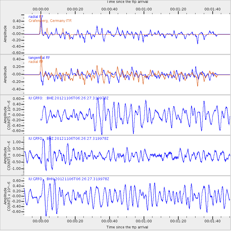
GRFO Grafenberg, Germany - Earthquake Result Viewer
*The percent match for this event was below the threshold and hence no stack was calculated.
| Earthquake location: |
Carlsberg Ridge |
| Earthquake latitude/longitude: |
10.0/57.2 |
| Earthquake time(UTC): |
2012/11/06 (311) 06:17:27 GMT |
| Earthquake Depth: |
10 km |
| Earthquake Magnitude: |
5.7 MB, 5.3 MS, 5.6 MW, 5.6 MW |
| Earthquake Catalog/Contributor: |
WHDF/NEIC |
|
| Network: |
IU Global Seismograph Network (GSN - IRIS/USGS) |
| Station: |
GRFO Grafenberg, Germany |
| Lat/Lon: |
49.69 N/11.22 E |
| Elevation: |
384 m |
|
| Distance: |
54.9 deg |
| Az: |
325.183 deg |
| Baz: |
119.993 deg |
| Ray Param: |
$rayparam |
*The percent match for this event was below the threshold and hence was not used in the summary stack. |
|
| Radial Match: |
60.365345 % |
| Radial Bump: |
400 |
| Transverse Match: |
69.66614 % |
| Transverse Bump: |
400 |
| SOD ConfigId: |
486604 |
| Insert Time: |
2013-03-08 04:55:43.723 +0000 |
| GWidth: |
2.5 |
| Max Bumps: |
400 |
| Tol: |
0.001 |
|
Signal To Noise
| Channel | StoN | STA | LTA |
| IU:GRFO: :BHZ:20121106T06:26:27.319978Z | 4.1537657 | 6.678387E-7 | 1.6077911E-7 |
| IU:GRFO: :BHN:20121106T06:26:27.319978Z | 1.8653531 | 3.8921146E-7 | 2.0865296E-7 |
| IU:GRFO: :BHE:20121106T06:26:27.319978Z | 2.5333836 | 3.4755163E-7 | 1.371887E-7 |
| Arrivals |
| Ps | |
| PpPs | |
| PsPs/PpSs | |


