You are here: Home > Network List > US - United States National Seismic Network Stations List
> Station HAWA Hanford, Washington, USA > Earthquake Result Viewer
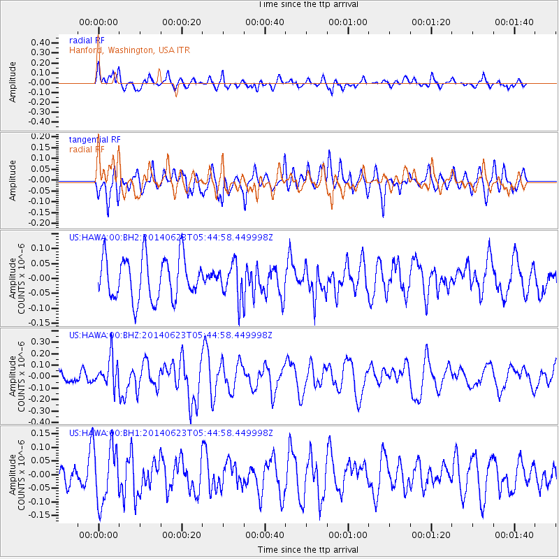
HAWA Hanford, Washington, USA - Earthquake Result Viewer
*The percent match for this event was below the threshold and hence no stack was calculated.
| Earthquake location: |
Tonga Islands |
| Earthquake latitude/longitude: |
-15.6/-173.1 |
| Earthquake time(UTC): |
2014/06/23 (174) 05:33:30 GMT |
| Earthquake Depth: |
15 km |
| Earthquake Magnitude: |
5.6 MW |
| Earthquake Catalog/Contributor: |
ISC/ISC |
|
| Network: |
US United States National Seismic Network |
| Station: |
HAWA Hanford, Washington, USA |
| Lat/Lon: |
46.39 N/119.53 W |
| Elevation: |
364 m |
|
| Distance: |
78.2 deg |
| Az: |
34.649 deg |
| Baz: |
232.344 deg |
| Ray Param: |
$rayparam |
*The percent match for this event was below the threshold and hence was not used in the summary stack. |
|
| Radial Match: |
53.75834 % |
| Radial Bump: |
400 |
| Transverse Match: |
54.255543 % |
| Transverse Bump: |
400 |
| SOD ConfigId: |
3390531 |
| Insert Time: |
2019-04-12 09:49:26.479 +0000 |
| GWidth: |
2.5 |
| Max Bumps: |
400 |
| Tol: |
0.001 |
|
Signal To Noise
| Channel | StoN | STA | LTA |
| US:HAWA:00:BHZ:20140623T05:44:58.449998Z | 1.6329935 | 1.3074735E-7 | 8.0066066E-8 |
| US:HAWA:00:BH1:20140623T05:44:58.449998Z | 1.863437 | 1.01489086E-7 | 5.446338E-8 |
| US:HAWA:00:BH2:20140623T05:44:58.449998Z | 0.8517701 | 6.057186E-8 | 7.111292E-8 |
| Arrivals |
| Ps | |
| PpPs | |
| PsPs/PpSs | |


