You are here: Home > Network List > US - United States National Seismic Network Stations List
> Station MSO Missoula, Montana, USA > Earthquake Result Viewer
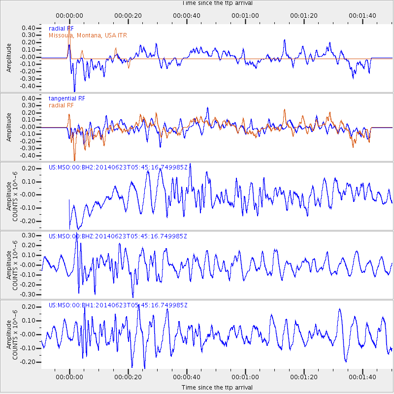
MSO Missoula, Montana, USA - Earthquake Result Viewer
*The percent match for this event was below the threshold and hence no stack was calculated.
| Earthquake location: |
Tonga Islands |
| Earthquake latitude/longitude: |
-15.6/-173.1 |
| Earthquake time(UTC): |
2014/06/23 (174) 05:33:30 GMT |
| Earthquake Depth: |
15 km |
| Earthquake Magnitude: |
5.6 MW |
| Earthquake Catalog/Contributor: |
ISC/ISC |
|
| Network: |
US United States National Seismic Network |
| Station: |
MSO Missoula, Montana, USA |
| Lat/Lon: |
46.83 N/113.94 W |
| Elevation: |
1264 m |
|
| Distance: |
81.6 deg |
| Az: |
36.559 deg |
| Baz: |
236.731 deg |
| Ray Param: |
$rayparam |
*The percent match for this event was below the threshold and hence was not used in the summary stack. |
|
| Radial Match: |
45.944725 % |
| Radial Bump: |
400 |
| Transverse Match: |
49.74608 % |
| Transverse Bump: |
400 |
| SOD ConfigId: |
3390531 |
| Insert Time: |
2019-04-12 09:49:30.157 +0000 |
| GWidth: |
2.5 |
| Max Bumps: |
400 |
| Tol: |
0.001 |
|
Signal To Noise
| Channel | StoN | STA | LTA |
| US:MSO:00:BHZ:20140623T05:45:16.749985Z | 2.540135 | 1.5115485E-7 | 5.950662E-8 |
| US:MSO:00:BH1:20140623T05:45:16.749985Z | 1.2559037 | 6.4444286E-8 | 5.131308E-8 |
| US:MSO:00:BH2:20140623T05:45:16.749985Z | 1.6723156 | 1.4412349E-7 | 8.618199E-8 |
| Arrivals |
| Ps | |
| PpPs | |
| PsPs/PpSs | |


