You are here: Home > Network List > TA - USArray Transportable Network (new EarthScope stations) Stations List
> Station TOLK Toolik Lake Research Station, AK, USA > Earthquake Result Viewer
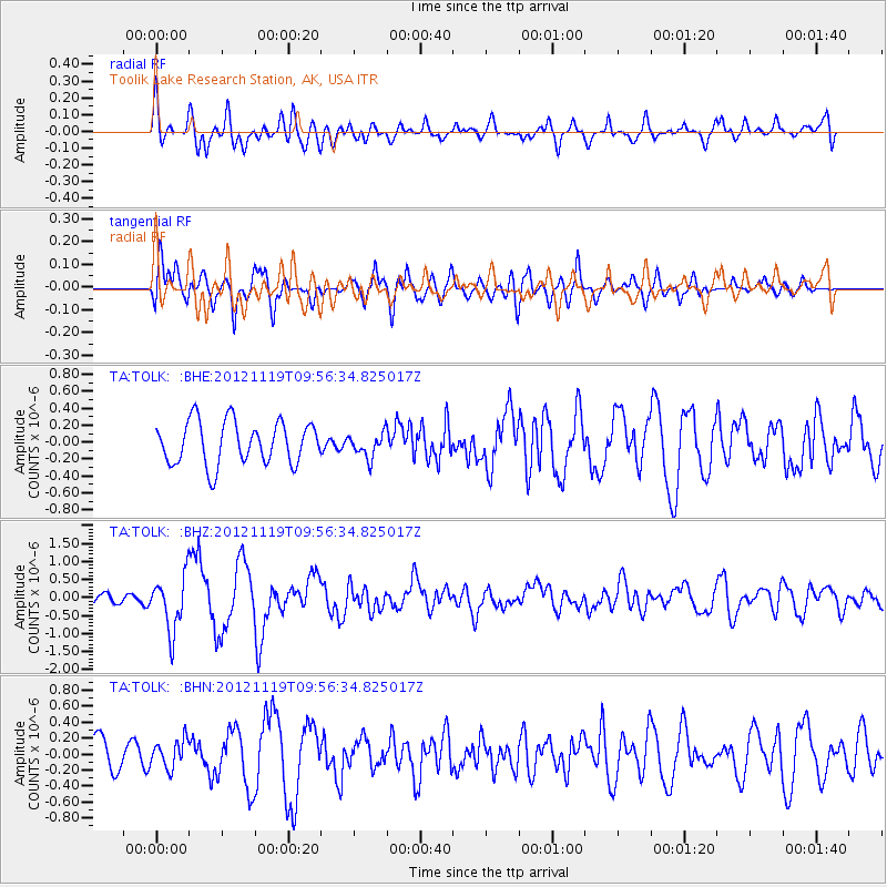
TOLK Toolik Lake Research Station, AK, USA - Earthquake Result Viewer
*The percent match for this event was below the threshold and hence no stack was calculated.
| Earthquake location: |
New Britain Region, P.N.G. |
| Earthquake latitude/longitude: |
-5.7/151.6 |
| Earthquake time(UTC): |
2012/11/19 (324) 09:44:34 GMT |
| Earthquake Depth: |
13 km |
| Earthquake Magnitude: |
5.9 MB, 5.9 MS, 6.0 MW, 5.9 MW |
| Earthquake Catalog/Contributor: |
WHDF/NEIC |
|
| Network: |
TA USArray Transportable Network (new EarthScope stations) |
| Station: |
TOLK Toolik Lake Research Station, AK, USA |
| Lat/Lon: |
68.64 N/149.57 W |
| Elevation: |
760 m |
|
| Distance: |
84.4 deg |
| Az: |
18.356 deg |
| Baz: |
238.808 deg |
| Ray Param: |
$rayparam |
*The percent match for this event was below the threshold and hence was not used in the summary stack. |
|
| Radial Match: |
72.94347 % |
| Radial Bump: |
400 |
| Transverse Match: |
61.835228 % |
| Transverse Bump: |
400 |
| SOD ConfigId: |
486959 |
| Insert Time: |
2013-03-21 19:24:11.455 +0000 |
| GWidth: |
2.5 |
| Max Bumps: |
400 |
| Tol: |
0.001 |
|
Signal To Noise
| Channel | StoN | STA | LTA |
| TA:TOLK: :BHZ:20121119T09:56:34.825017Z | 4.2986803 | 7.565515E-7 | 1.7599623E-7 |
| TA:TOLK: :BHN:20121119T09:56:34.825017Z | 0.72896934 | 1.7324238E-7 | 2.3765388E-7 |
| TA:TOLK: :BHE:20121119T09:56:34.825017Z | 0.57244134 | 1.4450156E-7 | 2.5243034E-7 |
| Arrivals |
| Ps | |
| PpPs | |
| PsPs/PpSs | |


