You are here: Home > Network List > UW - Pacific Northwest Regional Seismic Network Stations List
> Station PASS Maple Falls, WA, USA > Earthquake Result Viewer
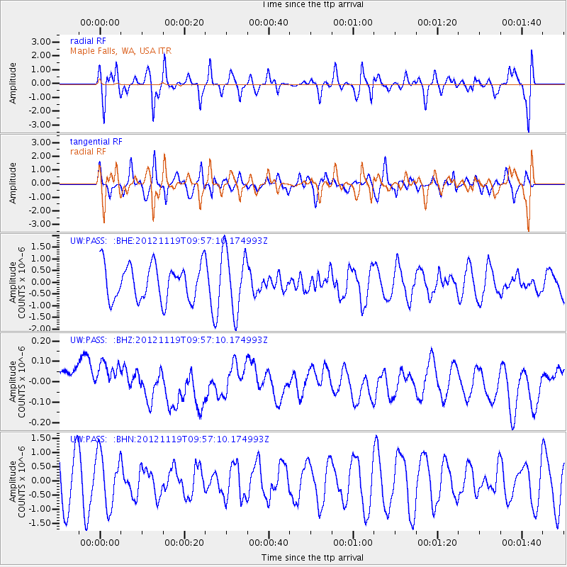
PASS Maple Falls, WA, USA - Earthquake Result Viewer
*The percent match for this event was below the threshold and hence no stack was calculated.
| Earthquake location: |
New Britain Region, P.N.G. |
| Earthquake latitude/longitude: |
-5.7/151.6 |
| Earthquake time(UTC): |
2012/11/19 (324) 09:44:34 GMT |
| Earthquake Depth: |
13 km |
| Earthquake Magnitude: |
5.9 MB, 5.9 MS, 6.0 MW, 5.9 MW |
| Earthquake Catalog/Contributor: |
WHDF/NEIC |
|
| Network: |
UW Pacific Northwest Regional Seismic Network |
| Station: |
PASS Maple Falls, WA, USA |
| Lat/Lon: |
49.00 N/122.09 W |
| Elevation: |
174 m |
|
| Distance: |
91.8 deg |
| Az: |
41.114 deg |
| Baz: |
263.497 deg |
| Ray Param: |
$rayparam |
*The percent match for this event was below the threshold and hence was not used in the summary stack. |
|
| Radial Match: |
64.77456 % |
| Radial Bump: |
400 |
| Transverse Match: |
43.178627 % |
| Transverse Bump: |
399 |
| SOD ConfigId: |
486959 |
| Insert Time: |
2013-03-21 19:25:05.884 +0000 |
| GWidth: |
2.5 |
| Max Bumps: |
400 |
| Tol: |
0.001 |
|
Signal To Noise
| Channel | StoN | STA | LTA |
| UW:PASS: :BHZ:20121119T09:57:10.174993Z | 1.1623679 | 9.716693E-8 | 8.359395E-8 |
| UW:PASS: :BHN:20121119T09:57:10.174993Z | 1.4628066 | 9.54169E-7 | 6.522865E-7 |
| UW:PASS: :BHE:20121119T09:57:10.174993Z | 1.7588538 | 1.3253432E-6 | 7.535266E-7 |
| Arrivals |
| Ps | |
| PpPs | |
| PsPs/PpSs | |


