You are here: Home > Network List > G - GEOSCOPE Stations List
> Station ATD Arta Cave - Arta, Republic of Djibouti > Earthquake Result Viewer
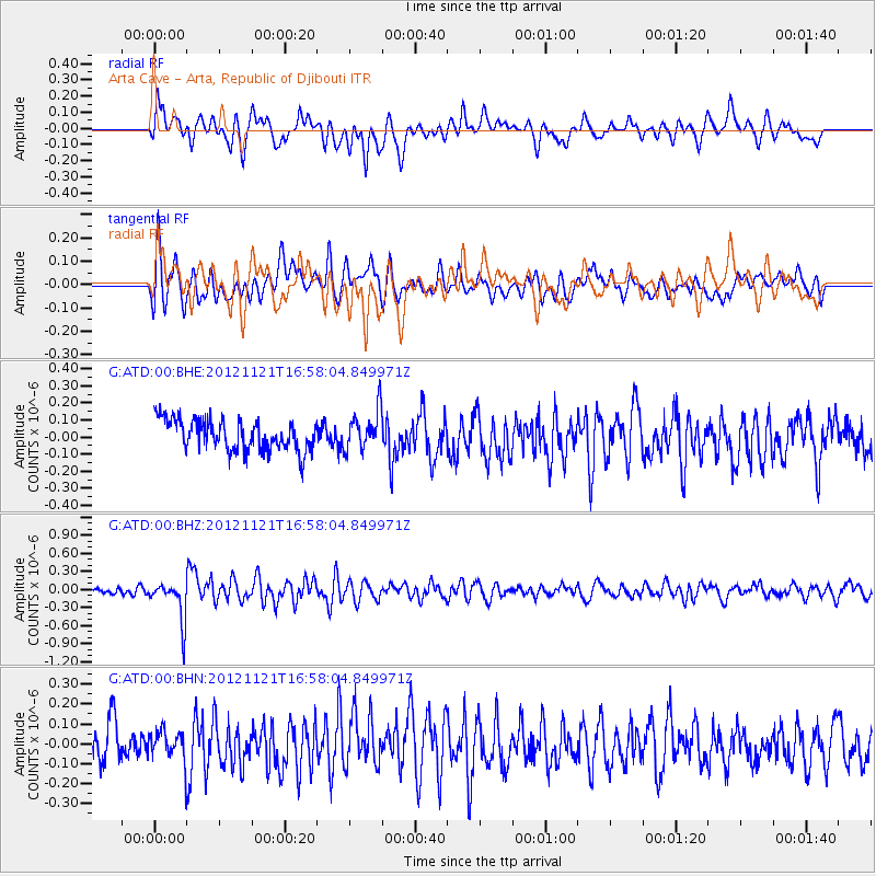
ATD Arta Cave - Arta, Republic of Djibouti - Earthquake Result Viewer
*The percent match for this event was below the threshold and hence no stack was calculated.
| Earthquake location: |
South Of Sumbawa, Indonesia |
| Earthquake latitude/longitude: |
-11.4/117.9 |
| Earthquake time(UTC): |
2012/11/21 (326) 16:46:40 GMT |
| Earthquake Depth: |
25 km |
| Earthquake Magnitude: |
5.8 MB, 5.1 MS, 5.4 MW, 5.3 MW |
| Earthquake Catalog/Contributor: |
WHDF/NEIC |
|
| Network: |
G GEOSCOPE |
| Station: |
ATD Arta Cave - Arta, Republic of Djibouti |
| Lat/Lon: |
11.53 N/42.85 E |
| Elevation: |
610 m |
|
| Distance: |
78.0 deg |
| Az: |
284.455 deg |
| Baz: |
104.321 deg |
| Ray Param: |
$rayparam |
*The percent match for this event was below the threshold and hence was not used in the summary stack. |
|
| Radial Match: |
61.907978 % |
| Radial Bump: |
400 |
| Transverse Match: |
56.05978 % |
| Transverse Bump: |
400 |
| SOD ConfigId: |
486959 |
| Insert Time: |
2013-03-21 19:26:17.081 +0000 |
| GWidth: |
2.5 |
| Max Bumps: |
400 |
| Tol: |
0.001 |
|
Signal To Noise
| Channel | StoN | STA | LTA |
| G:ATD:00:BHZ:20121121T16:58:04.849971Z | 3.7665205 | 3.273863E-7 | 8.692009E-8 |
| G:ATD:00:BHN:20121121T16:58:04.849971Z | 1.0502446 | 8.039821E-8 | 7.65519E-8 |
| G:ATD:00:BHE:20121121T16:58:04.849971Z | 1.2923968 | 1.154072E-7 | 8.929703E-8 |
| Arrivals |
| Ps | |
| PpPs | |
| PsPs/PpSs | |


