You are here: Home > Network List > TA - USArray Transportable Network (new EarthScope stations) Stations List
> Station R41A Rosebud, MO, USA > Earthquake Result Viewer
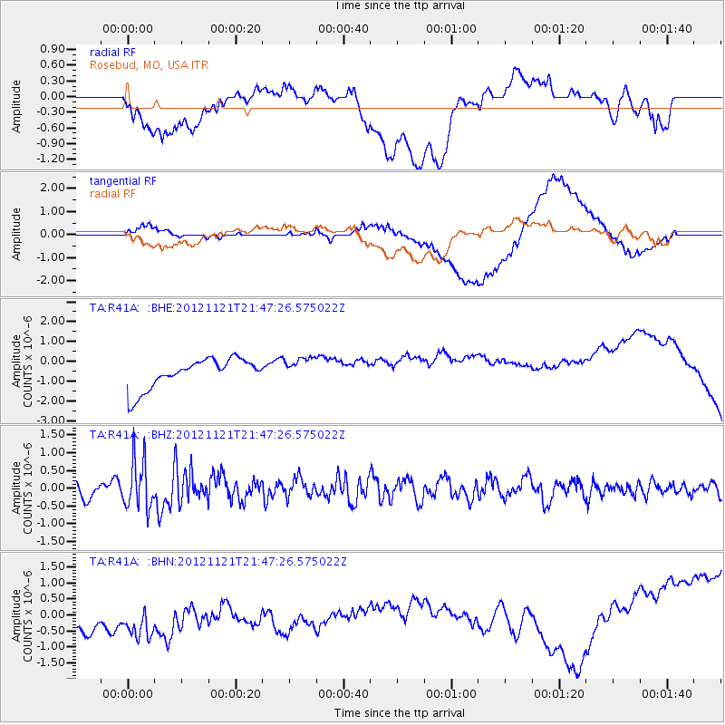
R41A Rosebud, MO, USA - Earthquake Result Viewer
*The percent match for this event was below the threshold and hence no stack was calculated.
| Earthquake location: |
Near Coast Of Central Chile |
| Earthquake latitude/longitude: |
-33.9/-71.9 |
| Earthquake time(UTC): |
2012/11/21 (326) 21:36:22 GMT |
| Earthquake Depth: |
18 km |
| Earthquake Magnitude: |
5.7 MB, 5.5 MS, 5.9 MW, 5.8 MW |
| Earthquake Catalog/Contributor: |
WHDF/NEIC |
|
| Network: |
TA USArray Transportable Network (new EarthScope stations) |
| Station: |
R41A Rosebud, MO, USA |
| Lat/Lon: |
38.30 N/91.38 W |
| Elevation: |
257 m |
|
| Distance: |
74.1 deg |
| Az: |
344.144 deg |
| Baz: |
163.221 deg |
| Ray Param: |
$rayparam |
*The percent match for this event was below the threshold and hence was not used in the summary stack. |
|
| Radial Match: |
16.143372 % |
| Radial Bump: |
400 |
| Transverse Match: |
22.187052 % |
| Transverse Bump: |
400 |
| SOD ConfigId: |
486959 |
| Insert Time: |
2013-03-21 19:39:46.884 +0000 |
| GWidth: |
2.5 |
| Max Bumps: |
400 |
| Tol: |
0.001 |
|
Signal To Noise
| Channel | StoN | STA | LTA |
| TA:R41A: :BHZ:20121121T21:47:26.575022Z | 3.1004539 | 6.7983837E-7 | 2.192706E-7 |
| TA:R41A: :BHN:20121121T21:47:26.575022Z | 0.90007305 | 2.0950815E-6 | 2.3276796E-6 |
| TA:R41A: :BHE:20121121T21:47:26.575022Z | 0.8235866 | 6.208077E-7 | 7.537856E-7 |
| Arrivals |
| Ps | |
| PpPs | |
| PsPs/PpSs | |


