You are here: Home > Network List > TA - USArray Transportable Network (new EarthScope stations) Stations List
> Station Q48A North Vernon, IN, USA > Earthquake Result Viewer
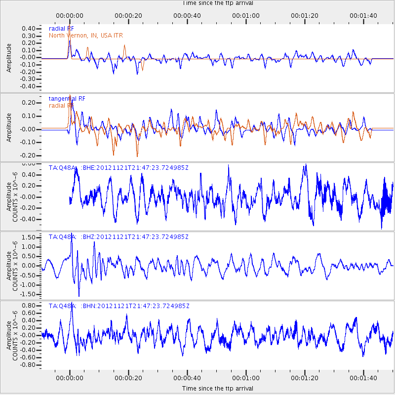
Q48A North Vernon, IN, USA - Earthquake Result Viewer
*The percent match for this event was below the threshold and hence no stack was calculated.
| Earthquake location: |
Near Coast Of Central Chile |
| Earthquake latitude/longitude: |
-33.9/-71.9 |
| Earthquake time(UTC): |
2012/11/21 (326) 21:36:22 GMT |
| Earthquake Depth: |
18 km |
| Earthquake Magnitude: |
5.7 MB, 5.5 MS, 5.9 MW, 5.8 MW |
| Earthquake Catalog/Contributor: |
WHDF/NEIC |
|
| Network: |
TA USArray Transportable Network (new EarthScope stations) |
| Station: |
Q48A North Vernon, IN, USA |
| Lat/Lon: |
38.93 N/85.73 W |
| Elevation: |
185 m |
|
| Distance: |
73.6 deg |
| Az: |
348.768 deg |
| Baz: |
168.018 deg |
| Ray Param: |
$rayparam |
*The percent match for this event was below the threshold and hence was not used in the summary stack. |
|
| Radial Match: |
60.684135 % |
| Radial Bump: |
400 |
| Transverse Match: |
52.07332 % |
| Transverse Bump: |
400 |
| SOD ConfigId: |
486959 |
| Insert Time: |
2013-03-21 19:49:41.022 +0000 |
| GWidth: |
2.5 |
| Max Bumps: |
400 |
| Tol: |
0.001 |
|
Signal To Noise
| Channel | StoN | STA | LTA |
| TA:Q48A: :BHZ:20121121T21:47:23.724985Z | 3.1670718 | 7.19201E-7 | 2.2708706E-7 |
| TA:Q48A: :BHN:20121121T21:47:23.724985Z | 1.9589772 | 3.4000297E-7 | 1.7356146E-7 |
| TA:Q48A: :BHE:20121121T21:47:23.724985Z | 0.7389728 | 1.575875E-7 | 2.132521E-7 |
| Arrivals |
| Ps | |
| PpPs | |
| PsPs/PpSs | |


