
DPC Dobruska, Czech Republic - Earthquake Result Viewer
| ||||||||||||||||||
| ||||||||||||||||||
| ||||||||||||||||||
|
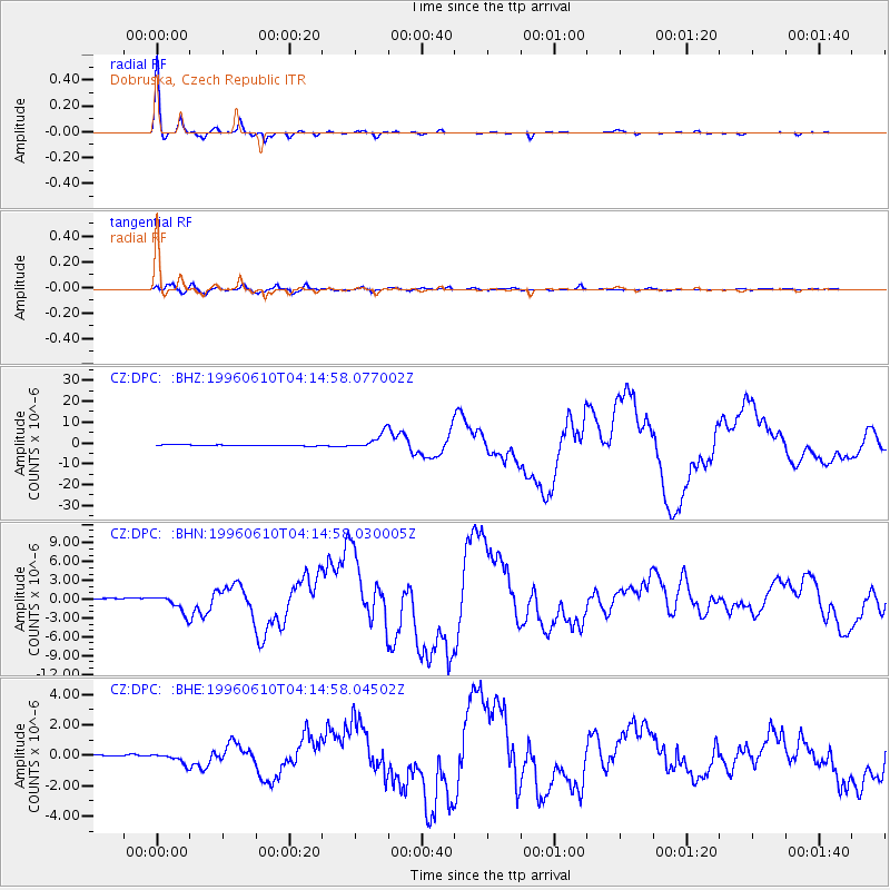
Signal To Noise
| Channel | StoN | STA | LTA |
| CZ:DPC: :BHN:19960610T04:14:58.030005Z | 13.434192 | 1.4833183E-6 | 1.10413666E-7 |
| CZ:DPC: :BHE:19960610T04:14:58.04502Z | 6.2879806 | 3.3032094E-7 | 5.253212E-8 |
| CZ:DPC: :BHZ:19960610T04:14:58.077002Z | 18.424 | 3.832927E-6 | 2.080399E-7 |
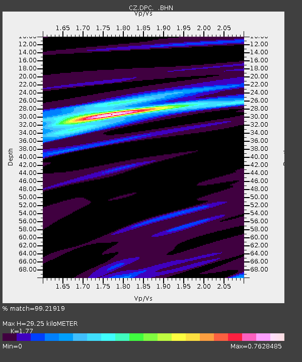
| Arrivals | |
| Ps | 3.7 SECOND |
| PpPs | 13 SECOND |
| PsPs/PpSs | 16 SECOND |

