You are here: Home > Network List > TA - USArray Transportable Network (new EarthScope stations) Stations List
> Station V44A Blytheville, AR, USA > Earthquake Result Viewer
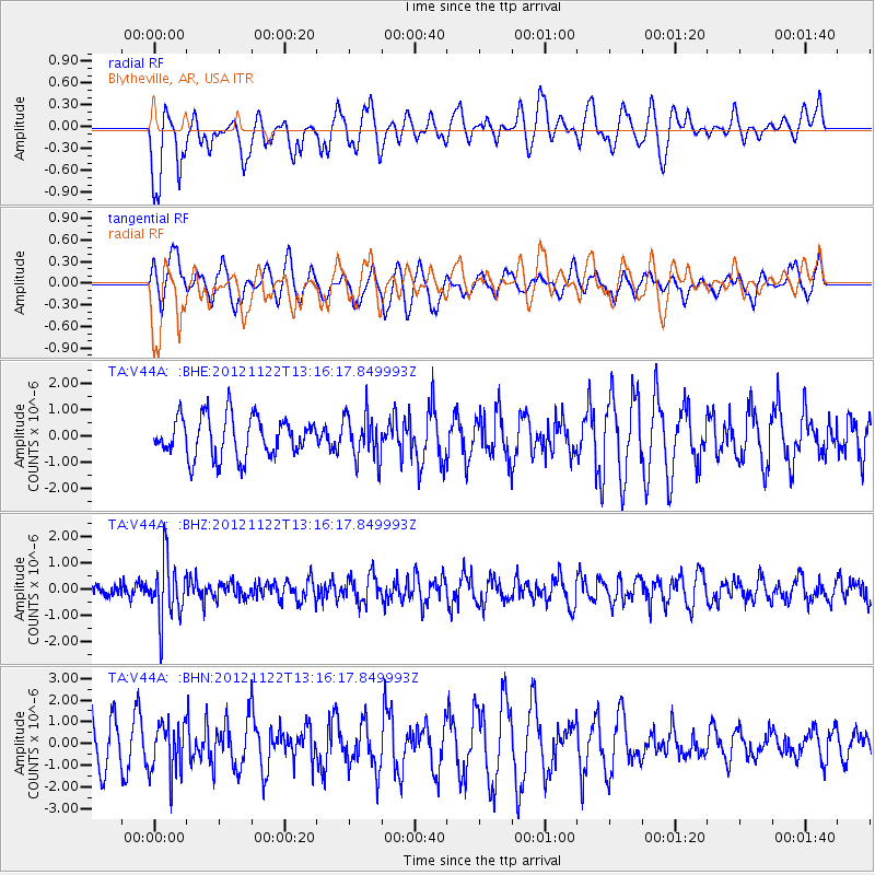
V44A Blytheville, AR, USA - Earthquake Result Viewer
*The percent match for this event was below the threshold and hence no stack was calculated.
| Earthquake location: |
Salta Province, Argentina |
| Earthquake latitude/longitude: |
-22.7/-63.6 |
| Earthquake time(UTC): |
2012/11/22 (327) 13:07:10 GMT |
| Earthquake Depth: |
517 km |
| Earthquake Magnitude: |
5.6 MB, 5.9 MW, 6.0 MW |
| Earthquake Catalog/Contributor: |
WHDF/NEIC |
|
| Network: |
TA USArray Transportable Network (new EarthScope stations) |
| Station: |
V44A Blytheville, AR, USA |
| Lat/Lon: |
35.83 N/89.90 W |
| Elevation: |
78 m |
|
| Distance: |
63.4 deg |
| Az: |
336.224 deg |
| Baz: |
152.741 deg |
| Ray Param: |
$rayparam |
*The percent match for this event was below the threshold and hence was not used in the summary stack. |
|
| Radial Match: |
53.395374 % |
| Radial Bump: |
383 |
| Transverse Match: |
49.849274 % |
| Transverse Bump: |
400 |
| SOD ConfigId: |
486959 |
| Insert Time: |
2013-03-21 20:09:00.254 +0000 |
| GWidth: |
2.5 |
| Max Bumps: |
400 |
| Tol: |
0.001 |
|
Signal To Noise
| Channel | StoN | STA | LTA |
| TA:V44A: :BHZ:20121122T13:16:17.849993Z | 4.8958526 | 1.1416721E-6 | 2.3319168E-7 |
| TA:V44A: :BHN:20121122T13:16:17.849993Z | 0.97388947 | 1.1730406E-6 | 1.2044906E-6 |
| TA:V44A: :BHE:20121122T13:16:17.849993Z | 1.1254635 | 8.539473E-7 | 7.587517E-7 |
| Arrivals |
| Ps | |
| PpPs | |
| PsPs/PpSs | |


